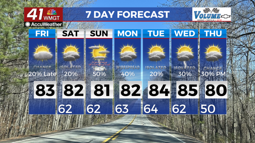
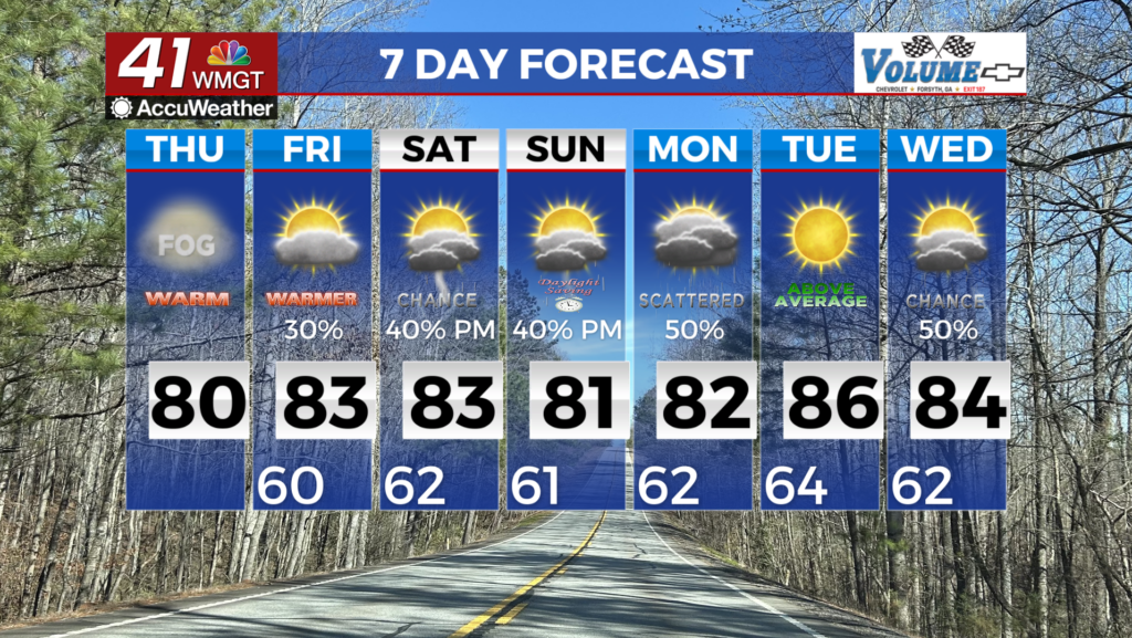
Drier days ahead of weekend rain and storms
MACON, Georgia. (41NBC/WMGT)- A stationary front to our south will be the main focus for rainfall for the rest of the work week.
TODAY.

Sunshine will mix with clouds this afternoon as temperatures climb back into the middle 80’s all across Middle Georgia. Our humidity will not be as bad as drier air tries to work into the region. A few showers are possible this afternoon and evening but rain chances remain very isolated. Tonight, temperatures will fall back into the upper 60’s and lower 70’s. A few clouds will hang around overnight.
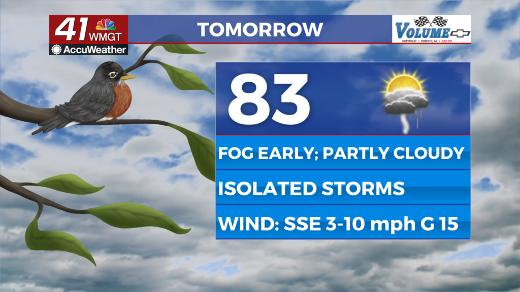
TOMORROW.

More of the same is on your way Thursday as temperatures are slightly warmer with highs in the upper 80’s to near 90° at times. A few isolated downpours are possible, but overall rain coverage will be very few and far between. Overnight lows will fall to near 70° which is just a few degrees cooler than our average low of 72° for this time of year.
FRIDAY & BEYOND.

Our rain chances will be going up slightly on Friday and into the weekend. Outdoor plans could be impacted by scattered showers and a few thunderstorms. Temperatures will be back in the low 90’s by Saturday as isolated rain chances remain in the forecast through early next week.

Follow Meteorologist Dalton Mullinax on Facebook (Dalton Mullinax 41NBC) and Twitter (@MullinaxWX) for weather updates throughout the day. Also, you can watch his forecasts Monday through Friday on 41NBC News at Daybreak (6-7 a.m.) and 41Today (11 a.m).

Leave a Reply