Drier and milder days ahead
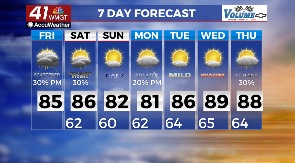
MACON, Georgia (41NBC/WMGT) – Deep moisture continues across the area through Saturday, with scattered, afternoon showers and thunderstorms. A weak cold front will finally sink south 
 across the area on Sunday, ushering in drier and milder conditions to much of the area. Temperatures will still be 5 to 10 degrees above normal. As the front pushes south, a weak wedge will develop across the northeast half of the area as surface high pressure slides over the Mid-Atlantic states. Another cold front approaches the area from the north by Wednesday, with increasing shower and thunderstorm activity across the northern portion of the region. Highs on Saturday will range from the mid 70s across the mountains to near 90 across the extreme south. As milder air filters in, lows Sunday morning will range from the mid 50s across the north to the mild 60s across the south. Daytime highs will gradually come down a degree or two each day through Monday, then start to warm back up by Tuesday and Wednesday.