Dangerous heat headed to Middle Georgia by midweek
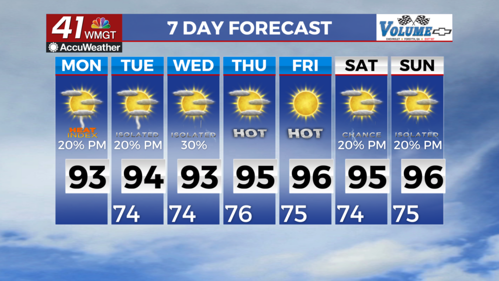
MACON, Georgia (41NBC/WMGT) – An old frontal boundary will stay in place for Monday and will act as a catalyst for another round of diurnally-driven showers and thunderstorms. High temps 


Monday are expected to be very similar to Sunday, with high reaching the low 90s. The main story this week will be rising temperatures and the potential for impactful heat by mid to late week. The set up responsible for these trends will be an eastward migrating mid-level ridge, currently over the Desert Southwest and high pressure at the surface. Any disturbances that translate through the mid-to-upper level flow may act to locally enhance convective activity on any given day. Otherwise, expect continued chances for daily afternoon to evening thunderstorms through this 


up coming week. Temperatures are expected to rise to the upper 80s to low 90s across most locations outside of the higher elevations. By Wednesday, temperatures will trend upward a degree or two each day going forward. Increasing moisture will support the return of dewpoints in the mid 70s. Heat index values (feels like temperatures) are forecast to return to the upper 90s to low 100s by mid to late week with the highest values over parts of eastern Georgia. In the meantime, please be mindful of the heat as you plan for any outdoor work or activities this coming week and be sure to take frequent breaks, and keep hydrated.