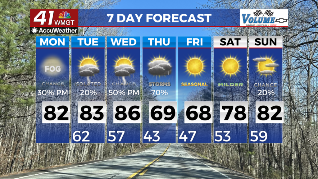

Cool, rainy weather hangs around Wednesday
Clouds and rain kept many of us cool across Middle Georgia today, and we can expect more of the same through the rest of the week.
An upper level low pressure system to our west (near Texas and Louisiana) continues to send moisture into the southeast, and continues our chances for scattered showers and thunderstorms through the end of the week.
Highs on Wednesday will be kept well below normal for this time of year, with temps topping out in the upper 70’s.
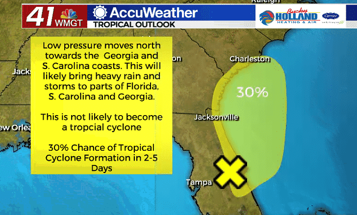
Not only that, we are also monitoring the possibility of an area of low pressure strengthening through Wednesday before making landfall in South Carolina. This area of low pressure has a 30% chance of becoming a tropical depression in the next 48 hours.
Regardless, expect heavy rain and storms to be associated with this system as it moves further north, especially to the east of the low pressure center.
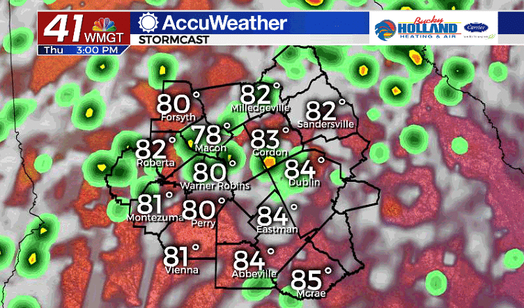
Thursday the cloud cover will finally start to break up, but once again we are expecting pretty widespread coverage of thunderstorms during the afternoon.
The expanded hours of sun will allow our highs to warm to the mid 80’s across Middle Georgia.
By Thursday night we will see the rain hang around and it looks to stay through Friday as well.
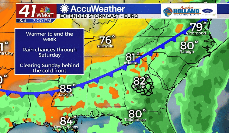
By Saturday we will finally see a cold front push through the area. This will finally clear out the rain that has been around all week.
A big cool down will follow the front by Monday, bringing highs back to the low 80’s to start next week. We will also stay dry through the start of next week.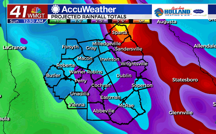
Between now and the weekend, expect some periods of heavy rain across Middle Georgia. While some areas could see over 4″ of rain, most of us will see between 1-2″ through the next 5 days.

Leave a Reply