Cool & dry for the start of the new week
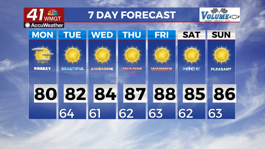
MACON, Georgia (41NBC/WMGT) – The front has officially pushed south of the area. We are not expecting much in the way of impactful weather however isolated storms could clip southeastern 

 counties with dewpoints in the low to mid 70s and temperatures near 90. Lightning and gusty winds would be the main threat for any of these isolated storms into the evening. Expect mainly dry conditions across much of the area with the cold front truly out of north and Middle Georgia. Winds could become gusty with gusts up to 20 mph possible. The other main story will be cooler temperatures with highs in the mid 70s to low 80s across the area with lows in the upper 50s to low 60s. We will not be approaching any temperature records but overall temperatures will be 3 to 5 degrees below normal. This along with the lower dewpoints will really make for a pleasant start to the week. The first couple of days of this week won’t quite be fall-like, but will offer a little taste of a cool down. Highs will be in the upper 70s to mid 80s. On Thursday, Friday and Saturday, highs will tick up into the mid to upper 80s. Temperatures in the mountains will be 5-10 degrees cooler.