
Cold and dry weather continues for Middle Georgia
MACON, Georgia (41NBC/WMGT) –


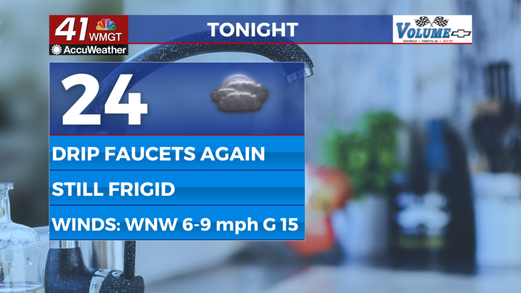
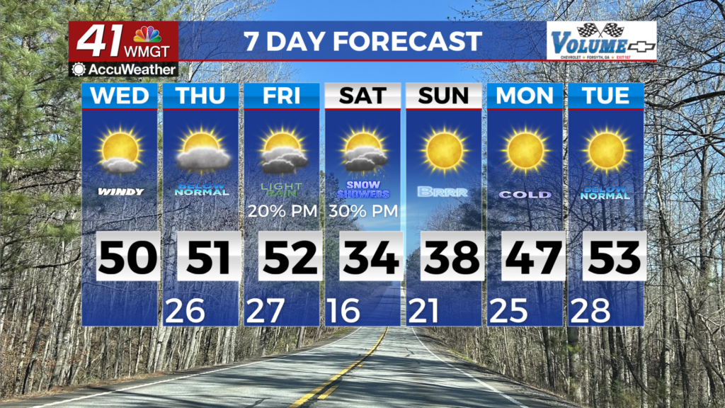
Strong high pressure will keep things cold and dry today. This morning temperatures won’t be quite as frigid as they were yesterday morning. Temperatures Wednesday morning will be in the 20s areawide. Skies will clear by mid-morning with temperatures rising into the 40s to low 50s. The only thing noticeable will be lower relative humidity each afternoon potentially falling below the 25% threshold. Areas south of Athens and east of Macon will possibly see relative humidity between 25-30 percent. These values may briefly dip below 25% but lighter winds and elevated fuel moisture should preclude any fire danger concerns. The long term forecast starts off quiet with cool to cold temperatures in the mid to upper 20s in the morning and 40s to near 50 for the high. Conditions this weekend will be at the mercy of several factors of increased uncertainty. Not so much in “will it snow or rain”, but “will there be precipitation or not?” At this time, any precipitation will likely come in the form of snow with limited or no transition period. Temperatures quickly fall below freezing Friday evening, with the development of a low somewhere over the eastern Gulf and Florida, Georgia and South Carolina coasts. The position of the low will be key when it comes to precipitation chances Friday and Saturday. Looking at the models, they are leaning towards the development of the surface low which brings moisture into the region along the backside of the system. On the other hand, there are other models that develop the low much further east, limiting moisture transport westward and system forcing. This would be the drier scenario. What this means for us is should we get precipitation, any moisture will likely be limited. Temperatures will be cold enough for snow and roads will be cold enough for frozen precip to stick. Total expected accumulations range from a dusting to 2 inches. The big caveat to this will be the westward moisture conveyor belt around the northwest side of the low. The further west and stronger the low development, the greater the moisture transport we could see. All precipitation should be out of the area by Sunday morning, although the cold will likely stick around through Tuesday morning. Lows Sunday through Tuesday will be in the low teens to low 20s.