
Cold air settles into Middle Georgia for the week
Today was a busy day in Middle Georgia with record rainfall, a big cool down, and a likely tornado in Irwin County. Luckily, the end of the week will bring much calmer weather to the area, before we ramp up our rain chances for the weekend.
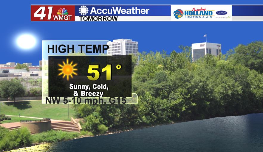
Wednesday will be a much cooler than what we have seen so far this week. We will see full sunshine through the day as well as a little bit of a breeze. Expect a wind chill through the day even though we have the sunshine back.
The rest of the week will pretty much be a repeat of what will see on Wednesday.
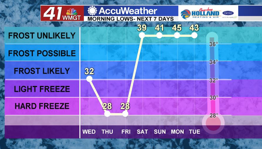
Low temps through the rest of the week drop into the 20’s! Be sure to have a way for your pets to get warm, as well as protecting sensitive plants and any pipes that may burst.
A small warm up moves in for the weekend, but so will rain chances.
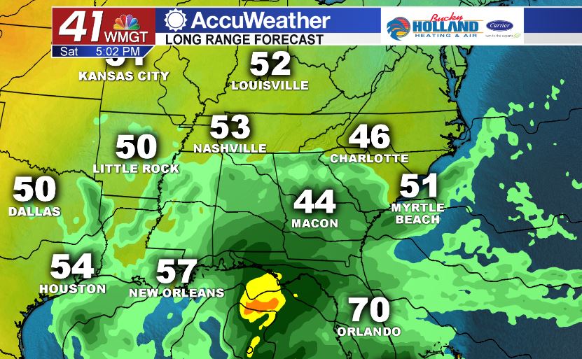
Most weather models are suggesting the chance for very heavy rain over the weekend. This will be from a system that will originate in the Gulf of Mexico…much like that big rain maker from the other week.
Rain totals could be up to 3″ across parts of Middle Georgia through Monday. This will have to be monitored through the rest of the week, especially considering how much rain we picked up today.


Leave a Reply