
Clouds move in as rain arrives Wednesday night
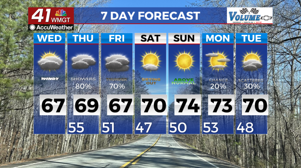
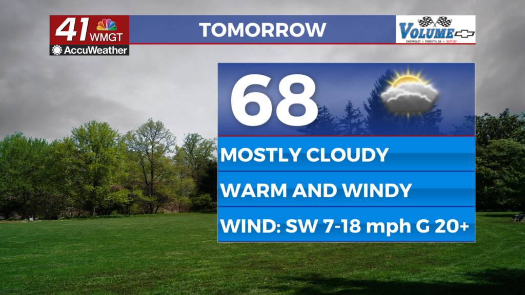
MACON, Georgia (41NBC/WMGT) – Today will characterized by southwest winds, returning moisture from the Gulf and areas of rainfall. The warm air gradually moving and returning moisture will be noticeable for all as temperatures move back into the 60s and areas of light rain develop in North Georgia. Any shower activity today should be focused along I-20. The best rain chance will 


occur at higher elevations and will be ongoing all day. A couple of weak shortwaves approaching from the west and a surface cold front sagging southwards will spread the rain chances into the rest of Georgia tonight and Thursday. The heaviest rainfall should occur on Thursday as daytime heating and the front mix. A few rumbles of thunder is possible. Severe weather appears unlikely, due to limited shear. Some storms may also occur north of the front and this will reduce the severe risk further. The heaviest rainfall amounts through Thursday evening should occur along and north of I-20, where 0.25 to 0.75 inches are anticipated. On Thursday night, a shortwave trough moves east across the Lower Mississippi River Valley, with an associated low centered to the northeast of Georgia. A cold front extending from this low enters North Georgia, with widespread showers ongoing to the immediate south. By early Friday morning, the shortwave enters North Georgia and the surface low lifts further northeast towards the Mid-Atlantic coast. The movement of this trough and low will help push the front southward through Georgia, and the axis of the most widespread and heavy precipitation continues to shift south. The front is expected to exit Middle Georgia by early Saturday, with only isolated showers lingering across portions of East-Central Georgia during the daytime. With temperatures remaining fairly warm through the end of the week, the precip type associated with this system will remain all liquid. Instability on Thursday and Friday will be limited, although forcing ahead of the front should be enough for isolated to scattered thunderstorms, most likely in Central Georgia on Friday. Organized severe weather is not expected at this time, although a couple of strong storms capable of producing gusty winds cannot be ruled out.