Clouds increase Friday afternoon ahead of weekend cold front
Temperatures will warm into the 80s once again Friday, but a cold front will bring in a chance of showers and storms overnight Friday

We have had a week of really nice weather across Middle Georgia, but rain chances return to the forecast Friday evening.
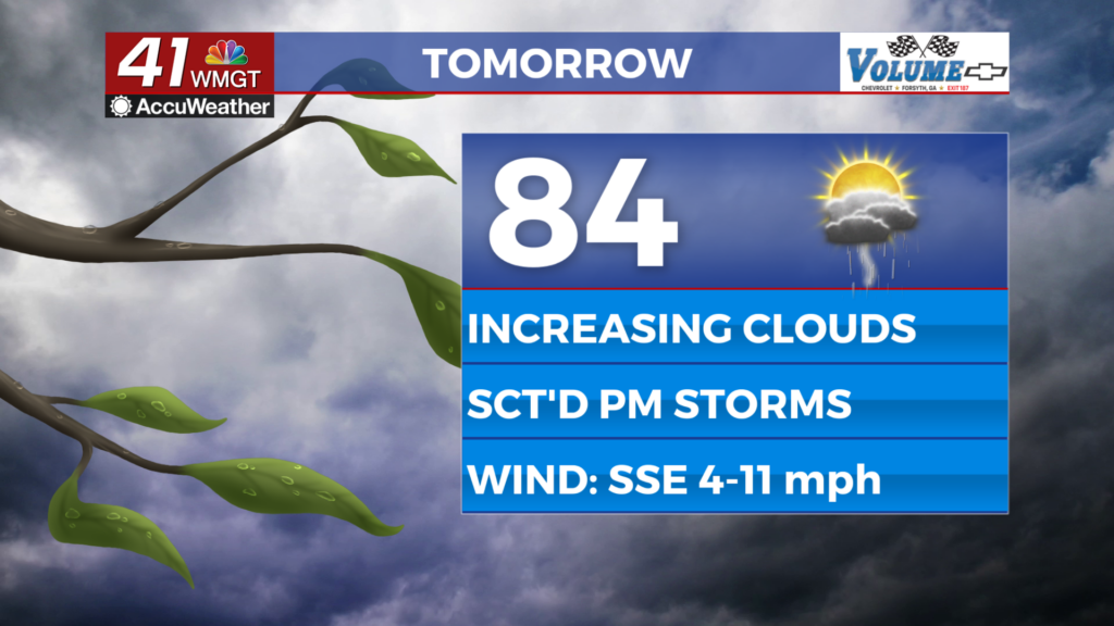
Highs throughout the day will still warm into the 80s on Friday, but clouds will start to increase by the afternoon.
A cold front will be approaching the area, but a broken line of storms will push ahead of the front.
This will bring a chance for showers and storms late Friday.
We could see a few pockets of heavy rain and rumbles of thunder, but severe weather is not likely.

By Saturday the actual front will be moving into the area.
Although most models are suggesting that we stay mostly dry, a few storms are possible by the afternoon.
This front will move out quickly and dry weather will resume Saturday evening.

While we are not expecting widespread severe storms ahead of the front, a few could be strong.
The main impact of any storms Saturday will be damaging wind gusts.

We will be drying out for the rest of the weekend with highs on Sunday staying in the mid 70s.
Monday will be a cool day for Middle Georgia with highs in the low 70s and partly cloudy skies.
Next week is going to be setting up a wetter pattern with rain and storms moving back in starting Tuesday.

Rain will continue through much of the end of next week, keeping temps cool.
We can’t rule out a few strong and severe storms for the middle of next week.