
A big warm up is on the way through the week…oh yeah, and more rain
Tomorrow:
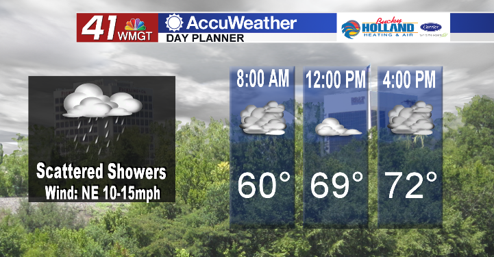
Once again we will see the chance for scattered showers and potentially an isolated thunderstorm. As a warm front continues to lift from the south we will also see a big warm up across Middle Georgia with highs making it back into the 70’s.
Friday:
By Friday our warming trend continues with highs making it into the upper 70’s, and the potential for a few peeks of sunshine by the afternoon. A stationary boundary will set up just to our north, so the focus of the precipitation will likely stay to our north during the day on Friday. Expect an increased chance of showers overnight and into Saturday.
Weekend:
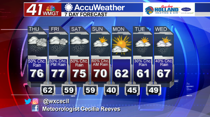
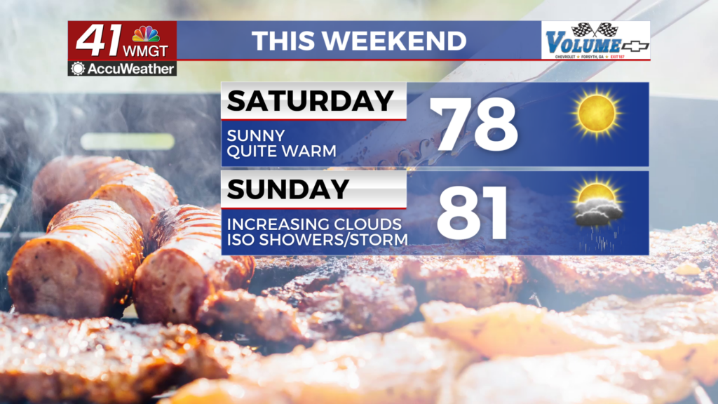
Through the weekend we will continue to see highs in the 70’s. Rain chances will hang around through much of the day on Saturday ahead of a cold front that will move through on Sunday. A big cool down will follow the front as well as clearing and drying through Tuesday.


Leave a Reply