Another round of strong storms possible today
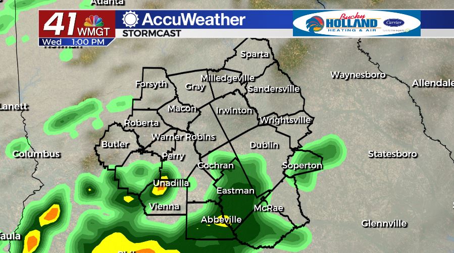
MACON, Georgia. (41NBC/WMGT)- Another chance for strong and severe storms is on tap today as a cold front approaches.
TODAY.

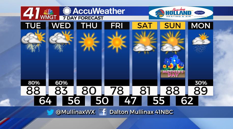
Under a partly cloudy sky this afternoon temperatures will warm into the middle and upper 80’s across Middle Georgia. Afternoon showers and storms could become strong, but our greatest severe weather threat looks to move in this evening and continue into the overnight hours. Damaging wind gusts, heavy rain, hail, and isolated tornadoes are all possible. Overnight lows will fall back into the middle 60’s.
TOMORROW.
We will keep some showers around through much of the day as the cold front takes it’s time moving through. Temperatures will top out in the low 80’s during the afternoon before falling into the middle 50’s overnight.
EXTENDED FORECAST.
A string of dry days will begin on Thursday. Behind a cold front we will be cooler and drier across Middle Georgia. We will only make it into the upper 70’s by Friday afternoon before we wake up with the upper 40’s by Saturday morning. Rain and near 90° temperatures will return early next week.
Follow Meteorologist Dalton Mullinax on Facebook (Dalton Mullinax 41NBC) and Twitter (@MullinaxWX) for weather updates throughout the day. You can also watch his forecasts Monday through Friday on 41NBC News at Daybreak (6-7 a.m.) and 41Today (11 a.m).


Leave a Reply