Another round of showers to start Friday
MACON, Georgia (41NBC/WMGT) – A cold front moving through the area will bring another round of showers and thunderstorms on Friday peaking midday through the afternoon and evening. 


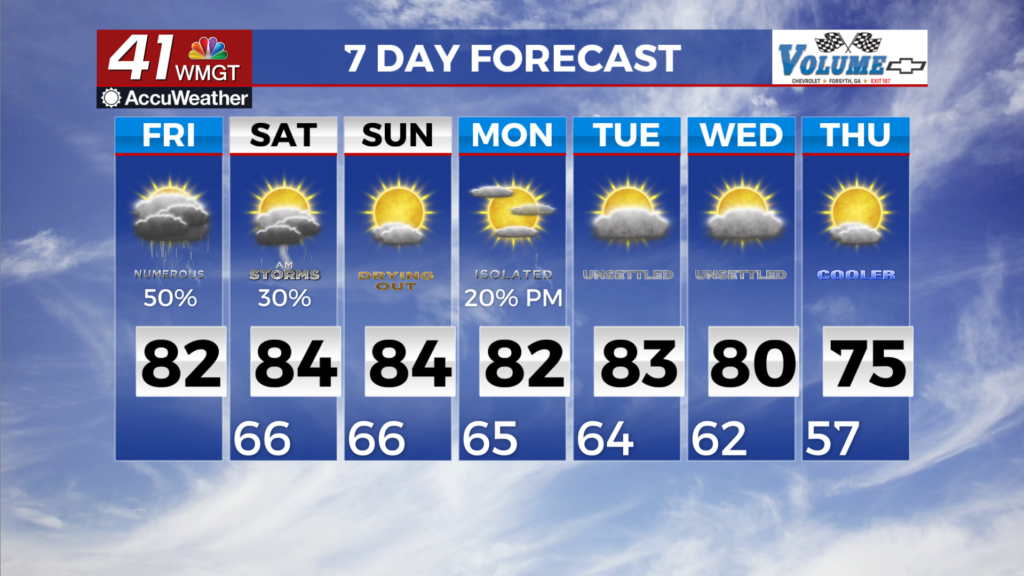
 The good news overall is that with increased cloud cover and the passing cold front, temperatures today will be more seasonable with highs in the mid to low 80s. The far southeast regions of the area may not be so lucky with the front progression and highs may still reach the upper 80s. Thunderstorm potential returns this afternoon, mostly in Middle Georgia, due to further frontogenesis around the base of the low as it moves over the coverage area. No severe weather is anticipated with this, however, a few rumbles of thunder may be possible. The long term begins as the cold front moves out and takes the rain with it. Drier and cooler conditions will set up on the backside for what will likely be another taste of early Fall. Highs in the upper 70s and low 80s are expected across most of the region with lower temps possible in the higher elevations. High pressure will keep conditions nice and dry for most the area as well so if you work or play outside, the start of next week will be for you! The tropics are making things quite tricky as we try to nail down next week’s forecast. We are carefully watching Invest 94 in the Caribbean Sea to see what it does. A few models have it heading towards the eastern seaboard, but regardless of the possibility of landfall, it’s presence will likely dominate the forecast. If it stays offshore, we will likely see a surge of dry air being inundated into the area. If it doesn’t stay offshore we definitely won’t be dry. As we get more information on the potential threat to Middle Georgia we’ll pass it along, but for now it’s just something to keep an eye on.