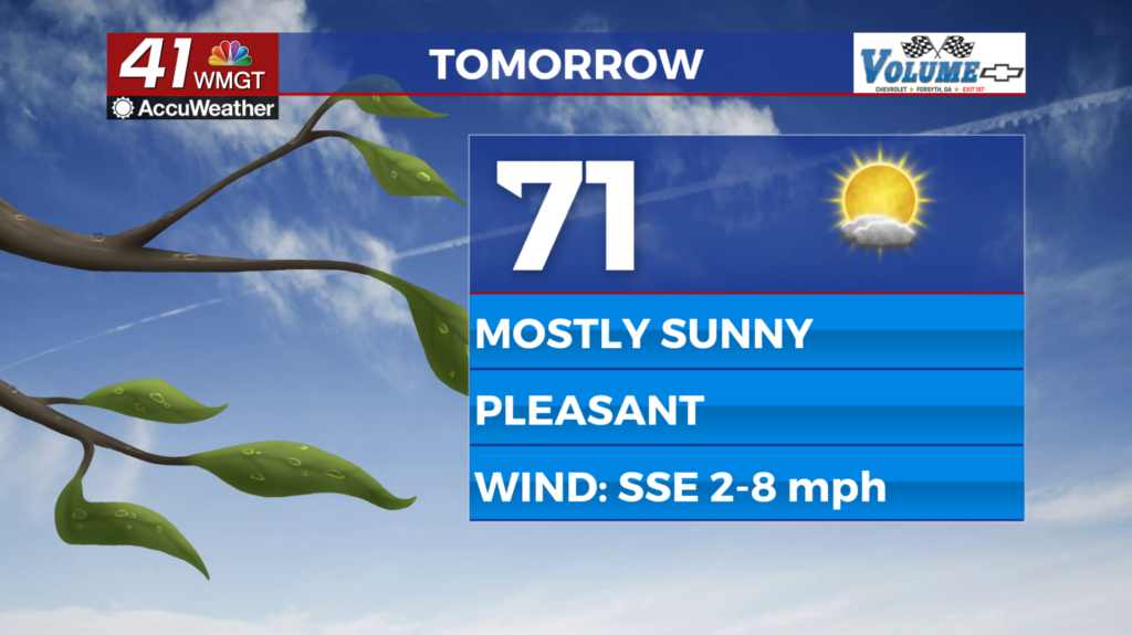
Another nice day before rain chances increase
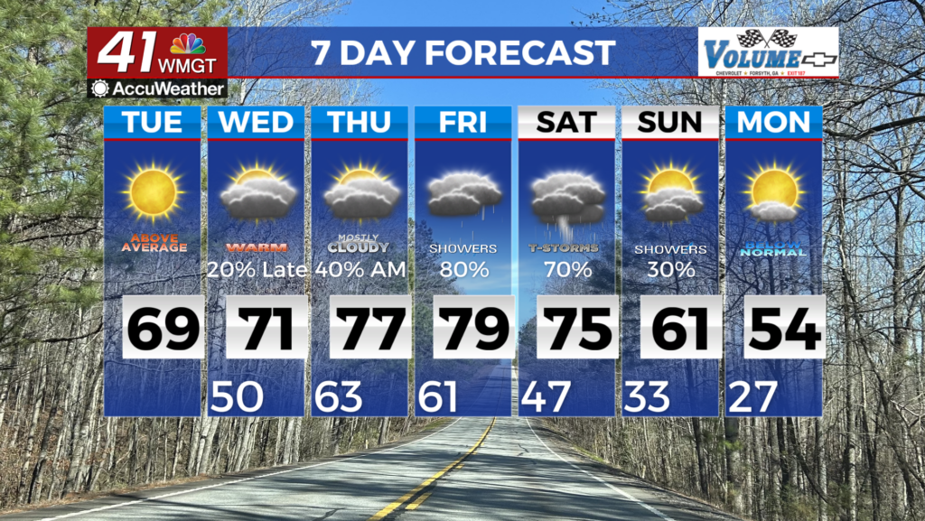
MACON, Georgia (41NBC/WMGT) – Upper level ridging and high pressure means generally calm weather through midweek. Upper level flow is highly amplified in the Great Lakes region, 


however this ridge feature undercuts itself with a strong southwest jet. Flow overhead remains out of the southwest as temperatures reach the upper 60s and low 70s. Moisture at the surface and clear conditions at night may cause fog to form. Our best chance for rain remains in terms of several weak shortwaves traveling along a flat ridge system. This may provide enough lift to generate light to patchy showers as early as Wednesday, however this remains extremely weak and most precipitation will likely struggle to overcome the high through the short term period. The most likely outcome will be overcast and warm conditions each day with potentially a stray shower or two on Wednesday. By late Wednesday into Thursday, models are in agreement showing moist southwest flow across the state and a weak frontal boundary sliding south out of Tennessee. This boundary does not have a lot moisture or dynamics with it but it does stall across North Georgia through Saturday. The main Bermuda-like ridge does not allow it to move too far south into the state which will keep us in the southwest flow. We expect on and off showers Thursday and Friday. A rumble thunder on Friday cannot be ruled out. The next main wave moves out of Central Texas Friday morning through the weekend. This next wave develops a trailing closed low center over Louisiana/Mississippi Saturday morning which moves east across Alabama/Georgia Saturday night into early Sunday morning. This will be our best chance of seeing thunderstorms so we will be keeping a close eye on how this develops over the next few days. The cold front associated with the closed low pushes south and east of the state early Sunday afternoon with strong gusty northwest winds behind it.