Another foggy start and very mild temperatures for Wednesday
MACON, Georgia (41NBC/WMGT) – The key words of this forecast are rinse and repeat with areas of dense fog over most of North and Middle Georgia. This will last through at least 10 AM to 


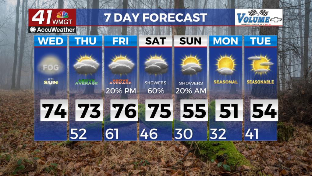
 possibly 11 AM in some areas. Models are indicating that much of the far southeast portions of Central Georgia are unlikely to see dense fog. We expect skies to eventually clear this afternoon, giving many areas their first chance of sunshine in a couple of days. Continuing southwest flow will be the factor in play today and Thursday prepping the area for the potential for active weather towards the end of the week and into the beginning portion of the weekend. Ridging and zonal flow allows for plenty of moisture and Warm Air Advection to enter the area. Temperatures for today and tomorrow will soar into the low to mid 70s across much of the area which will be around 20 degrees above normal. Records could be tied or broken. Lows will be in the upper 40s to low 50s across the area. Fog could be an issue again tomorrow morning across the southwest. Models are beginning to come together on a solution for the rain and thunderstorms expected Friday and Saturday. The increased hazard has now shifted from a severe concern towards an amount of moisture associated with this system. The combination of the approaching dragging cold front, a broad warm front, and some orographic forcing, the heavy rain potential increases. Another concern is some of these bands could cause training which could lead to flooding. All in all, the worst case scenario, our area could possibly be looking at significant rainfall amounts.