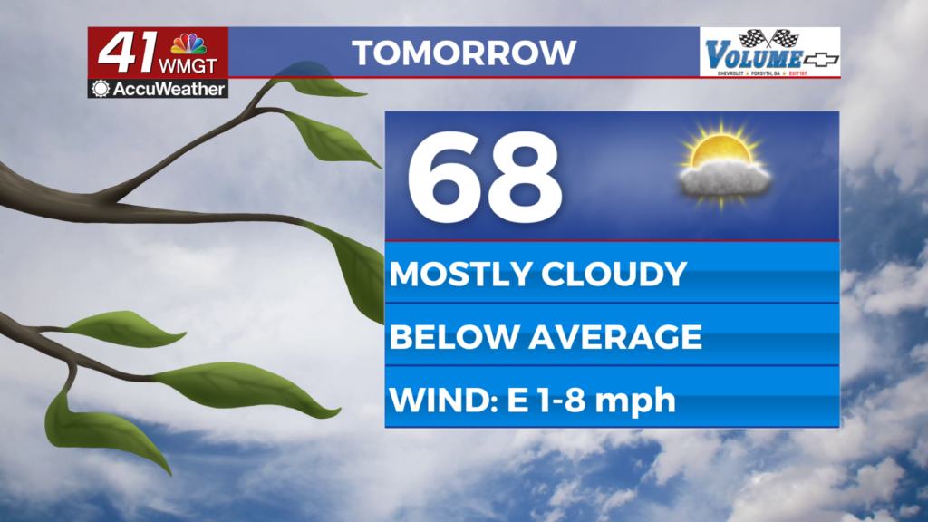
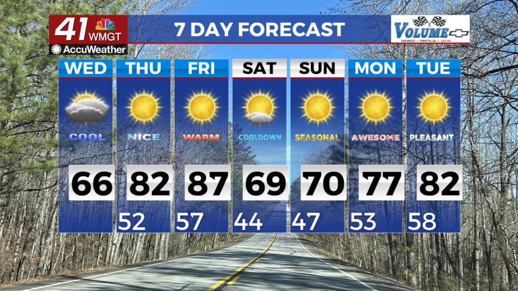
Another cool day before a warm up
MACON, Georgia (41NBC/WMGT) – Current satellite image shows mainly mid to high level clouds streaming across the area. These clouds are associated with moist easterly flow setting up 


around the bottom of a high pressure ridge that is centered over the Mid-Atlantic states. This ridge is keeping things dry for the most part, however, we are definitely seeing increased moisture in the atmosphere. The moist easterly flow continues through the short term as the ridge remains parked over the eastern seaboard. Expect more overcast skies today with this flow but still not expecting any precipitation. Temperatures will be a bit cooler than the past few days with highs mainly in the 60s to lower 70s. After the normal to slightly below normal temperatures in the short term, a warming trend returns for Thursday and Friday as a mid to upper level ridge slides east across the southern U.S. High temperatures are expected to return to the 80s both days. A southward advancing dry airmass will push a weak cold front into north and Middle Georgia Friday night through Saturday night. Moisture will be limited both along and ahead of the front, so precipitation is not expected. The exception could be light sprinkles across far north Georgia. The change in airmass ushered in by the front will bring high temperatures in the mid 60s to lower 70s on Saturday and Sunday. Sunday morning is shaping up to bring the coolest temperatures of the long term period— generally in the 40s. The cooler temperatures will be short-lived, with high temperatures returning to the mid 70s to upper 70s areawide on Monday as high pressure situates to the east of the coverage area and the axis of upper level ridging shifts directly over the Southeast.