Afternoon thunderstorms likely for Wednesday
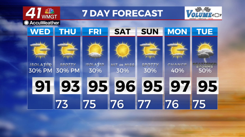
MACON, Georgia (41NBC/WMGT) – Rain chances shift to Middle Georgia as the low pressure system moves across Florida. This area is more likely to see waves of precipitation due to the tropical 

 environment. Main threats are gusty winds, frequent lightning, and locally heavy rainfall. With the rainfall, and temperatures in the low to mid 90s, heat index values should stay in the 100-105 range. Models are in agreement with a tropical disturbance moving across north Florida and out over the Northern Gulf today. This feature is expected to track west over the next 48 hours and over southern Louisiana on Thursday. While not expected to pose a direct threat to Georgia, this disturbance will provide sufficient moisture to the region. As a result, expect daytime driven isolated to scattered showers and thunderstorms to continue through the weekend. Although the threat of severe storms is low in this pattern, sufficient moisture and surface heating could produce a few strong storms. Given the moisture, any training or slow moving storms could pile up the rainfall. Temperatures will trend well into the mid to upper 90s.