Afternoon storms highlight Thursday
MACON, Georgia (41NBC/WMGT) – Thursday begins with the region residing on the eastern side of an upper-level ridge stationed over the Four Corners region, along with a broad troughing 


pattern diving towards our area from the Midwest. This setup supports northwest flow and will likely spin off a couple of rounds of shortwave disturbances beginning Thursday afternoon. The Storm Prediction Center has issued a Marginal Risk (Level 1 out of 5) of severe weather. Storms that do form could produce microbursts with strong winds, hail, and heavy rainfall. Heat concerns will also return Thursday afternoon, with heat index values rising into the triple digits. A Heat Advisory has not been issued however it may be needed for some portions of Middle Georgia.


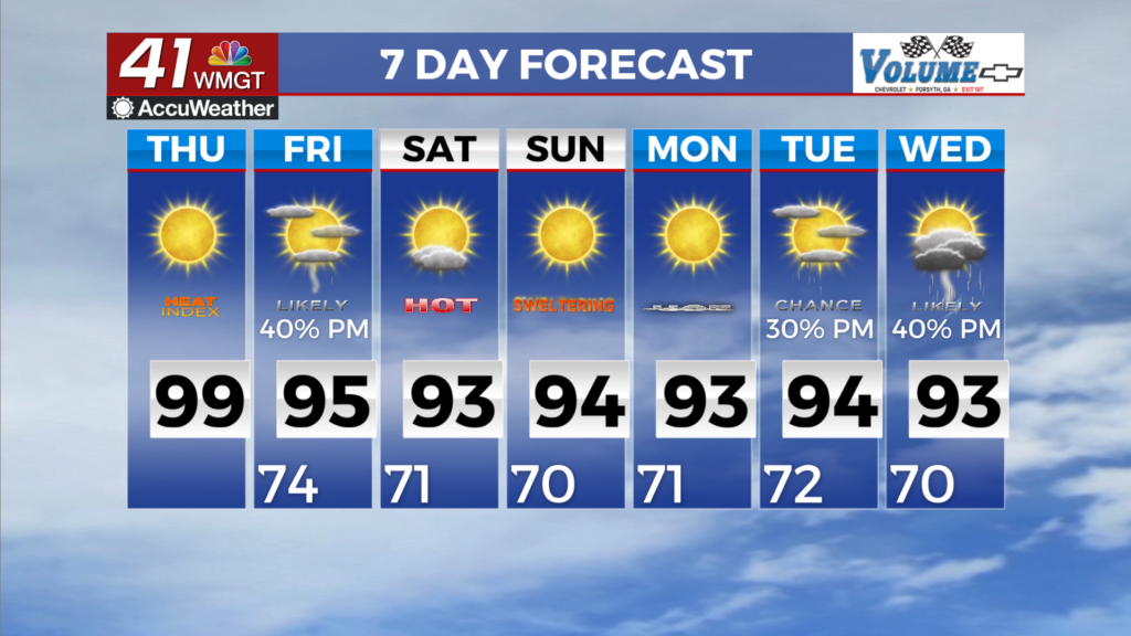
Highs will remain in the 90s through the long term. The big concern will be the heat index values which will remain in the triple digits into the weekend. Luckily, a front is set to take aim at the area towards the end of the week. While temperatures will remain in the 90s, the front will help ease Heat Index values out of the triple digits. The chance for thunderstorms continues on Friday, especially across northern Georgia where there appears to be at least some chance of strong to severe weather associated with the northwest flow pattern that is expected to set up. The threat here 
will be mainly wind although some localized flash flooding is possible. After the front clears on Saturday, chances of afternoon storms drops for the remainder of the weekend. The cautionary here, we remain in a northwest flow pattern through the start of next week. As a result, there is a possibility that a MCS (Mesoscale Convective System which is a complex of organized storms) makes its way out of the Great Lakes region, that could impact some portions of the Southeast during that time. As we move into next week, we return to a more stagnant pattern with Heat Index Values rising back towards heat advisory criteria.