

Afternoon heavy rain and storms target Middle Georgia
MACON, Georgia (41NBC/WMGT) – We expect very similar conditions from yesterday to carry over into Tuesday. An upper trough shifts off to the west as a broad area of southeast flow looks to 


develop along the I-16/I-75 corridors into Middle Georgia. Model guidance is in generally good agreement that a developing band of convection within a confluence zone will lead to a bout of numerous afternoon showers and thunderstorms. Also, within this zone there is a possibility for a few storms could be strong to severe with locally damaging wet microbursts, excessive rainfall, and flash flooding potential. Deeply saturated storm profiles and slow storm motions with clusters of storms could yield isolated pockets of rainfall. The placement of these isolated pockets is 

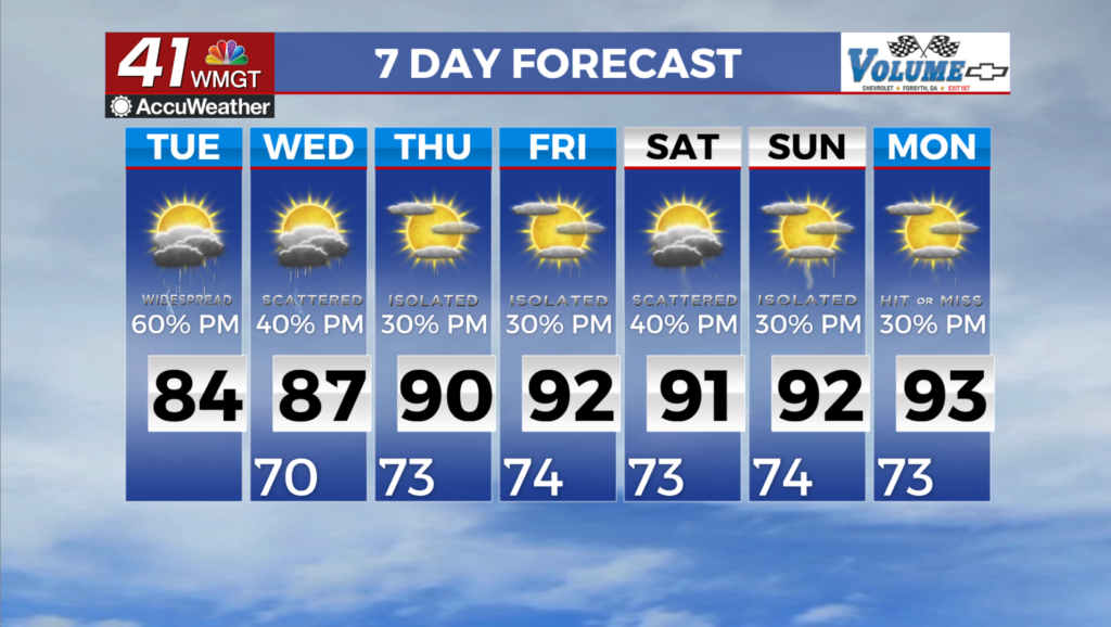
highly uncertain and could occur practically occur anywhere. Isolated flash flooding will be possible where any of these set up shop, especially in urban areas. As an elongated zone of weakening ridging continues to reside to the north, a relative zone of low pressure will remain in place across the south central and southeastern U.S. The more organized low pressure center near our coverage area today will weaken and retrograde westward towards Texas, with time into midweek trending Georgia back towards a more typical summer convective pattern with more isolated to scattered thunderstorm coverage (instead of widespread) expected each afternoon and evening driven largely by diurnal heating. Heavy rainfall continues to be a risk with thunderstorms. High temperatures in the mid to upper 80s Wednesday will trend back up each day into the low to mid 90s by Friday, holding there for the upcoming weekend.