Above normal temperatures kick off the new week
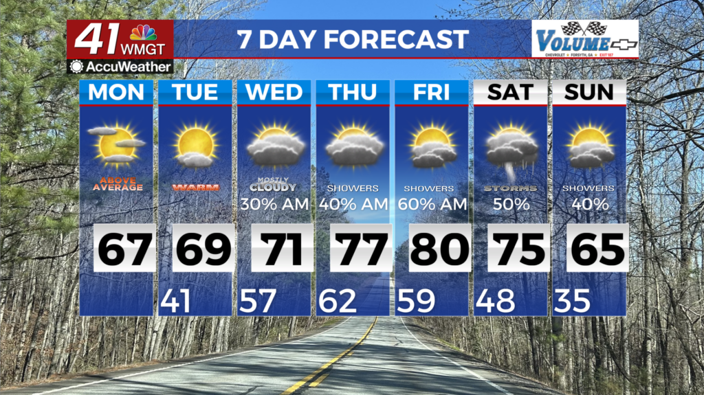
MACON, Georgia (41NBC/WMGT) – A quiet weather starts Monday off with morning clouds giving way to widespread afternoon sunshine. Temperatures will get into the mid 60s. An upper level 


 ridge and high pressure builds over the Southeast U.S. through the first half of the work week, keeping conditions dry and warm. As the center of the ridge shifts from over the Gulf to over the Caribbean midweek, winds over Georgia will turn out of the southwest, bringing in an even warmer airmass for the second half of the week. Models remain strong agreement that high temperatures will climb from the upper 60s to low 70s on Tuesday, to low to mid 70s Wednesday, and mid to upper 70s for Thursday and Friday. Some low 80s will even be possible across Middle Georgia. We could see some daily records be tied or broken for warmest high and low temperatures during the second half of the week across the area. Dry conditions prevail through Wednesday with the ridge axis and high pressure remaining over the region. Late Wednesday into Thursday, models remain in good agreement on the first in a potential series of shortwave troughs crashing into the ridge, bringing enough moisture to support light rain. Following this, another wave move into the area on Friday, with even better chances for rain over the weekend as the ridge breaks down.