A wet start to the week leads to cooler temps
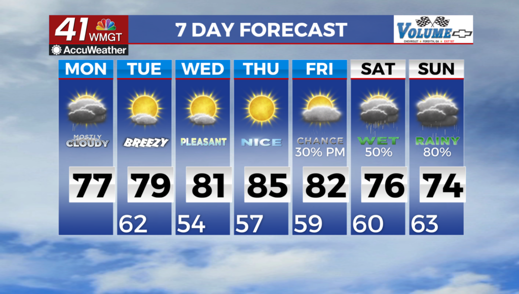
MACON, Georgia (41NBC/WMGT) – Precipitation has been slower to start than what was advertised. We are finally seeing rain build in across the region as deeper moisture continues to push 


into the coverage area. This is representative of the airmass ahead of the wedge/Cold Air Damming that has pushed into Northeast Georgia and has mostly stalled, which is still moist naturally drier just as a by-product of being cooler. The question you may want to ask is what has taken so long for the rain to get going in some locations and the answer to that is moisture transport. It’s difficult to get lift in the atmosphere if the air isn’t moving. That’s changing as the rain builds in. For the rest of the day, we will keep a few showers around under mostly cloudy skies. The showers 


will be light in nature however, higher totals of 3 to 5 inches could be possible, especially across Middle Georgia where rain may be a bit heavier at times this morning. The wedge has stalled with high pressure over the Northeast moving off the coast. Low cloud cover will likely lock it in place for the rest of the afternoon and evening with little in the way of various processes to break down the cap until cooler air moves in tonight and breaks down the inversion. Winds turn northernly, bringing an end to the moisture transport and the end of precip across northern Georgia. The surface front looks like it may struggle to push into the air, as the surface high over the upper Great Plains lags behind with a secondary shortwave embedded in the trough over the Midwest and Northeast. Temps will likely be lower as the cloud cover lingers. High are expected to be in the upper 70s and low 80s, as dewpoints remain in the upper 60s to lower 70s. The front should arrive into the area Monday night into early Tuesday as high pressure pushes to the east. This should remove some of the surface moisture and allow temperatures to drop into the upper 50s and lower 60s across most of the area. Dry air settles in across much of the area north of a line from Columbus to Augusta with highs in the mid to upper 70s. Overnight lows will fall into the 50s. By the time we get to Thursday, rain chances for the region drops to nearly zero. The National Hurricane Center is keeping an eye on a disturbance off the Yucatan that has a 30 percent chance for development. Right now, all of the models are developing it into some kind of tropical system with landfall expected somewhere along the Gulf near eastern New Orleans. This would bring another round of wet weather to the area by next week, but the extent and intensity of this system is only speculation.