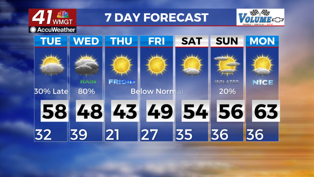
A very cold and wet Wednesday, then a frigid couple of days
MACON,GEORGIA (41NBC/WMGT)- In the near-term, a ridge of high pressure will remain in place.
We expect a surface low to develop along a stalled warm front across the northern Gulf late Tuesday- very
early Wednesday. Precipitation will spread northward across much of the region as the low moves east along
the Gulf coast.
Precipitation chances begin to increase very late Tuesday night as the shortwave energy approaches from the
west. Precip will start off light. Most areas will experience a cold rain, however, temperatures across the mountains
of North Georgia will be cold enough for wintry precipitation. Models are showing the dominate precip types as rain
or wet snow. Some sleet could mix in.
As the day continues, temps are expected to increase into the early afternoon which will result in a changeover to
mostly rain except for high elevations which will see snow. Overnight Wednesday into Thursday rain chances will
decrease as the low pushes further east.
After the low pressure system exits, temperatures will plummet into Thursday with temps 10 to 15 degrees below normal.
Highs on Thursday will struggle to reach above 40 for much of the area except Middle Georgia which should get to 45-50.
Into the weekend into early next week, expect mostly dry conditions with temperatures slowly rising through the weekend
into early next week.