


A touch of Fall continues before end of week warm up
MACON, Georgia (41NBC/WMGT) – The extended forecast remains dry through the end of the week as surface high pressure remains in place under an upper level trough over the eastern U.S. 


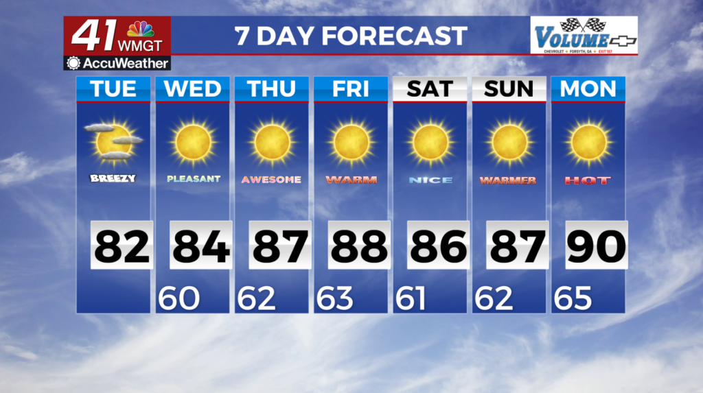
 This surface level riding will keep the area precipitation-free, except for a small area in east Central Georgia that has a non-zero but low chance. In addition, this setup will support warming high temperatures through the week, although wedging will keep these highs from soaring into the 90s. In general, expect afternoon temperatures in the mid 80s to near 90 (which is 1 to 6 degrees above normal) by Thursday, and plateauing through the weekend. Overnight lows should stay largely in the 60s, with 5 to 10 degrees cooler in the mountains. Beyond the weekend looks to stay similarly warm. Models have the above-normal late-summer temperatures persisting into next week. Here’s hoping we can get another taste of fake Fall, or just go ahead with real Fall.