A brief cooldown for Friday, followed by warming trend for the weekend
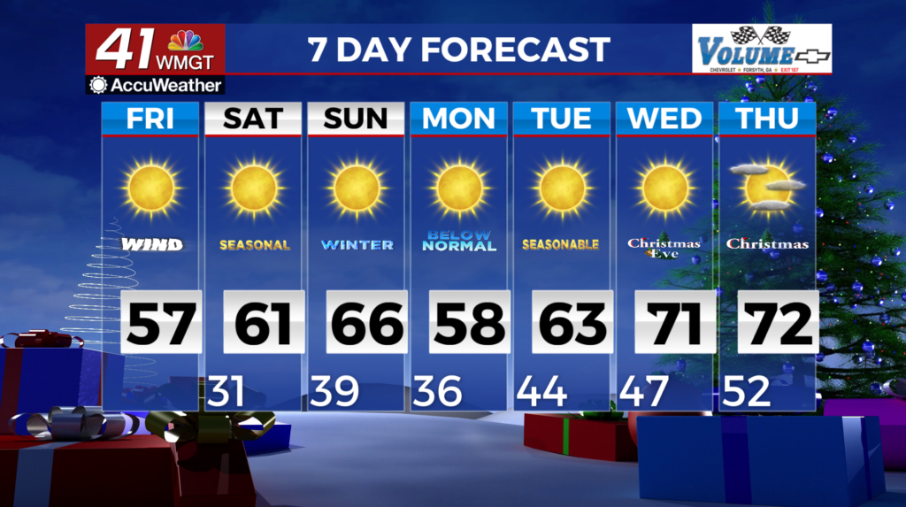
MACON, Georgia (41NBC/WMGT) – A weakening line of gusty showers and storms associated with a cold front is actively moving through north and Middle Georgia early this morning, dropping 


 0.25-0.5 inches of rain. Following the frontal passage, deep northwest flow and surface high pressure will usher in a cooler and drier airmass for the end of the work week. By sunrise most of the area will be under clear skies with breezy northwest winds. High temps will only reach the upper 40s to low 50s across north Georgia, with mid to upper 50s across Central Georgia. Under clear skies and weakening winds Friday night, overnight lows will fall to the upper 20s to low 30s. During the day Saturday, high pressure shifts off to the east, and winds will turn out of the south, initiating a warming trend. Skies will remain mostly clear, and high temps will climb into the upper 50s to low 60s, making for a very pleasant start to the weekend.