

A boo-tiful but chilly Halloween
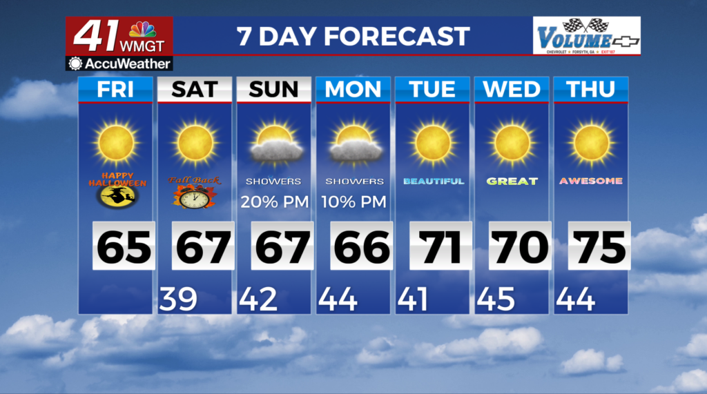
MACON, Georgia (41NBC/WMGT) – The combination of dry, northwesterly flow and high pressure inching eastward from across the middle of the country supports clearing and drying conditions. Clearing skies and the effects of yesterday’s cold front will have folks waking up to lows in the 30s to near 40. Depending on the timing of the erosion of low-level clouds and 


 winds slacking, some patchy frost is possible from across far north and far west Central Georgia Friday morning. For any Halloween or trick or treating activities, keep a jacket handy. Expect temperatures to be in the mid-50s to lower 60s then dropping into the mid 40s to mid 50s by 9 PM. Friday night lows will be cooler still, in the mid to upper 30s areawide. The combination of clear skies, calm winds, and temperatures between 33 and 36 degrees will possibly support patchy frost. Cool and dry weather will start the weekend on Saturday, although clouds will begin to increase by the latter half of the day in North Georgia. By Sunday, an upper low dives southeastward across the Tennessee Valley. The latest models have determined in better agreement regarding the scenario of low-end chances for light rain showers late Sunday into early Monday. Beyond Monday, we will return to dry conditions through the remainder of the week. High pressure will build across the region in the wake of Monday’s cold front. After below normal highs over the weekend into Monday, daytime highs will gradually warm back up towards normal by midweek, as the high shifts east and surface flow becomes more southerly.

