

Staying cool Thursday, storms return Saturday
A cold front is slowly bringing cold air into Middle Georgia this evening under clear skies.
Those clear skies will allow for cooling into the upper 30’s by early tomorrow morning, but we are not expecting any frost, so all of our plants/gardens should be fine.
Highs tomorrow will be a bit cooler than today, but it will be a bit less breezy.
Friday will bring some warmer conditions across the area, but also more moisture and cloud cover.
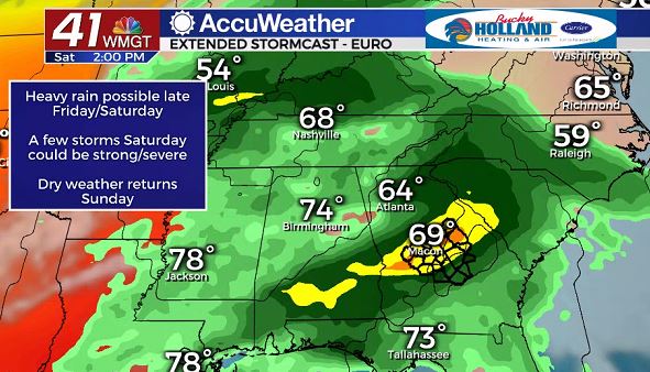
Late Friday/early Saturday a storm system will begin to approach the area with heavy rain and thunderstorms.
Although we don’t know timing for sure yet, the latest models signal the strongest storms will be moving through during the afternoon.
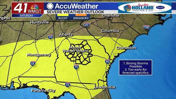
Main threats with any storms Saturday will be damaging winds, heavy rains (potential for flash flooding), large hail, and a brief tornado.
As always, be sure to have a way to get your warnings and stay weather aware this weekend.
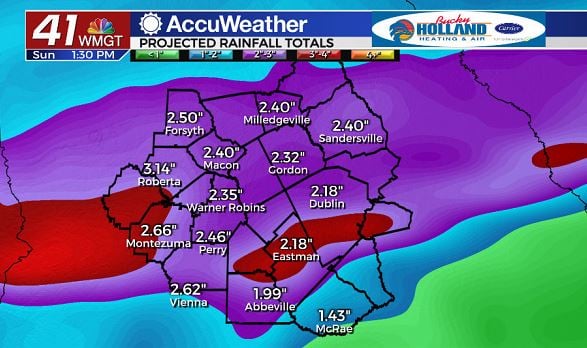
Rain totals across Middle Georgia could range 1-3″ between Friday and early morning Sunday.
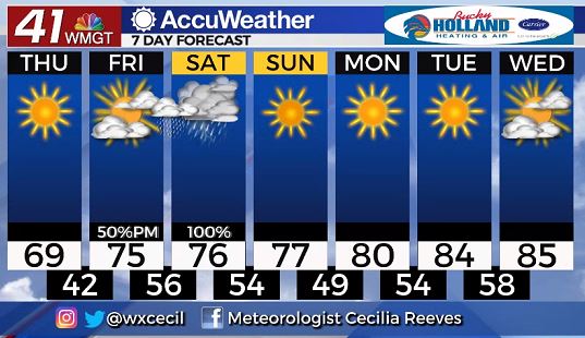
The rain will be short lived across Middle Georgia, moving out on Sunday.
Through next week will continue to see a warming trend, getting us back into the 80’s.
Stick with 41NBC through the next few days as we get a better handle on the severe weather threat Saturday.
Leave a Reply