

Staying dry and warm Tuesday
Clear skies and low humidity made for a pretty nice Monday across Middle Georgia (at least weather-wise).
More dry weather is in store for our area through much of the rest of the week, but we will see some temperature changes over the week.
Tomorrow will bring some cloud cover to the area through the day, with some clearing by Tuesday evening.
Highs will be the warmest that we will see all week, staying mainly in the upper 70’s.
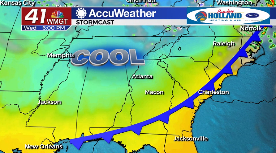
By Wednesday a dry cold front will be pushing across the southeast, bringing cool, breezy weather, but likely not any rain or storms.
This cooler air will settle in on Wednesday night, dropping our overnight lows on Thursday morning to the upper 30’s and low 40’s.
Highs on Thursday will struggle to make it into the low 70’s.
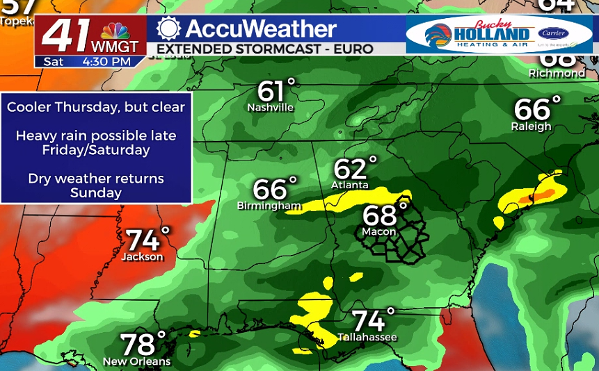
By Friday, we will be seeing a pretty quick rebound from the cool conditions that push in from the cold front.
Clouds will begin to move in Friday ahead of our next weather maker, which brings us our first significant chance of showers in over a week.
The storm system Saturday looks to be quite moisture rich, meaning although it will only be around for one day, heavy rain could bring the area 1-2″ of rain in a 24 hour period.
A few strong storms are possible Saturday, but they are not expected to be widespread.
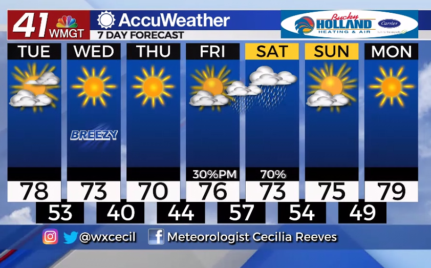 Rain and storms will be moving out pretty quickly, leaving us with a dry day on Sunday.
Highs will be warming through the start of next week back to the upper 70’s and low 80’s.
Leave a Reply