
A few showers and wedge front keep parts of the area cool Friday
After a day of record heat in Middle Georgia, some of us will be seeing a big drop in our high temps.
The cooler conditions that some of us will be seeing come from a wedge front that will be trapping cold air in our area (the northern portion).
A stationary boundary that is situated over Middle Georgia will guide our next chance of rainfall, keeping the heaviest rain to our north (with the cooler temepratures).
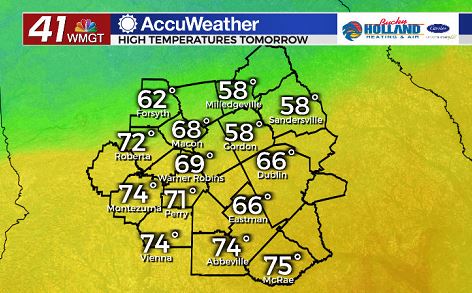
To the south of the stationary boundary, highs will be much warmer with a few areas seeing some sunshine.
By later in the afternoon, many of us will see our temps getting a lot closer to normal, but even if it is cool on Friday, warm weather is back for the weekend.
Saturday will be a dry day in the area with highs warming to the upper 70’s and low 80’s.
This will be the best day to get out and about in Middle Georgia, before rain moves back in on Sunday.
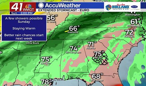
On Sunday you can expect a chance for showers and maybe even an isolated thunderstorm, but it will be staying quite warm through the end of the weekend.
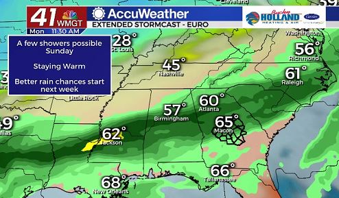
By Monday a weak cold front will be bringing more rain to the area, and this time the rain and storms will be widespread.
This front will also be impacting our high temperatures, finally cooling us off to the mid and low 60’s.
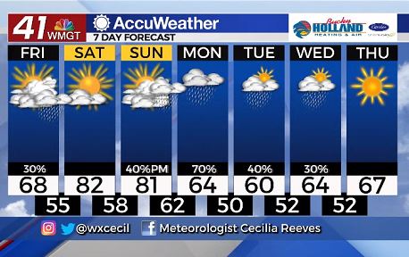
The cooler weather will likely be sticking around for much of next week.
We are still seeing some differences from the models on what to expect for the middle of next week, but right now it looks like scattered showers will be possible.

Leave a Reply