
Staying warm ahead of late week rain chances
Warm weather continues for Middle Georgia on Thursday as a weak cold front attempts to push further south.
The cold front will be bringing some additional cloud cover from north to south, as well as an isolated rain chance.
Highs will once again be in the 70’s with lows Thursday night staying pretty mild thanks to the increasing cloud cover.
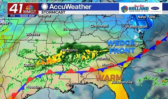
By Friday the cold front will stall over our area, becoming a stationary boundary.
Not only will we be dealing with this boundary, but also a wedge front building in from the north that will be keeping parts of North Georgia pretty chilly on Friday.
Highs in metro Atlanta will be limited to the 40’s and 50’s while areas of Middle Georgia (south of the stationary boundary) will be in the 60’s and 70’s.
Rain chances will be increasing through the afternoon and evening on Friday, but we are not expecting much of a thunderstorm threat.
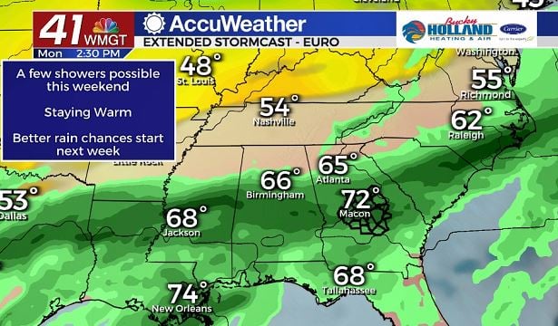
The weekend should be relatively quiet in our area, with a few showers possible on Sunday and maybe a thunderstorm.
Highs over the weekend will be warming into the 70’s and low 80’s under partly to mostly cloudy skies.
Heavier rain and storms will be possible to start next week, as we will also see a cool down.
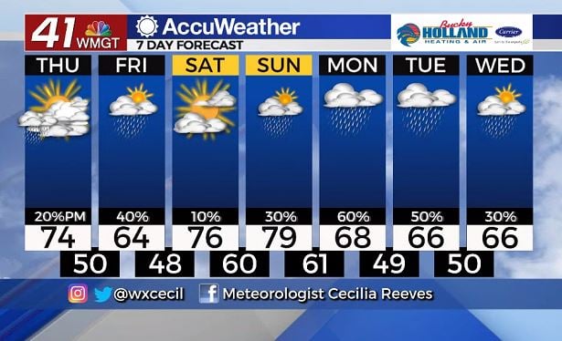
Next week there are some questions about when the rain will finally be moving out, but as of right now it looks like we will be seeing a cold front moving through by the middle of the week.
High temps will be cooling to around or just above normal for this time of year.


Leave a Reply