
Mild through the weekend, turning colder for Thanksgiving
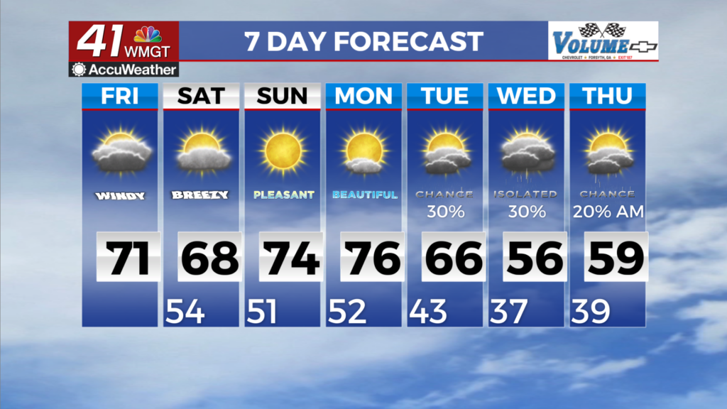
MACON, Georgia (41NBC/WMGT) – A mid level cloud deck extending north into Atlanta and Athens, has kept temperatures moderated in the mid to upper 60s. In North Georgia the breakdown 


of the ridge has dropped dewpoints and has lowered relative humidity levels. In some areas of Northeast Georgia relative humidity has dropped into the teens which has prompted a fire danger. Winds will continue out of the east. Dry air will continue over North Georgia today with relative humidity currently forecast to reach into the 30 to 35 percent range. There is a chance that relative humidity will dip into the 20 percent range. Middle Georgia on the other hand, will have moisture streaming into the area which will result in increased cloud cover and relative humidity. Models are indicating light showers remain possible for areas along and south of a line from Columbus and Macon through today. Amounts will generally be less than a tenth of an inch. Lows tonight will 

dip into the upper 40s to low 50s over much of the area with lower 40s in the northern tier before warming into the mid 60s. The extended period begin Saturday morning with the developing low center just off the north Florida/Georgia coast becoming the dominant weather feature. This low is expected to continue to develop through the weekend as it moves northeast across the Carolinas and Mid-Atlantic states into the beginning of next week. With this low center expected to stay east of the area, the most we will see across North and Middle Georgia will be increased cloud cover and some gusty winds. Some portions of East Georgia may see a shower or two Saturday afternoon through Sunday morning with the lows center proximity just east of the state. There is also another weak frontal boundary that moves east across the area Monday but it is very weak with little dynamics or associated moisture. We are only expecting increased cloud cover again from this frontal passage. At the same time there is an open wave developing along the Gulf coast that moves out across the Central Gulf by Monday night. Increased moisture from this wave moves into South and Middle Georgia Tuesday morning/afternoon. High temperatures Saturday through Monday will be mainly in the 60s and 70s with a slight cool down Tuesday and Wednesday with highs in the 50s and 60s. Low temps will do the same thing with lows Saturday through Monday in the 40s and 50s then cooling into the 30s and 40s Tuesday and Wednesday.