
Rain chances go up and last until Saturday
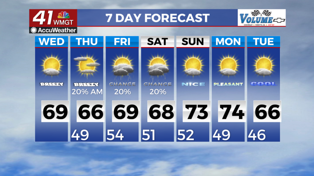
MACON, Georgia (41NBC/WMGT) – Temperatures are expected to remain mostly seasonal with highs in the upper 60s and lower 70s during the day and upper 30s and lower 40s during the 


overnight hours. A few showers are expected along and south of a line from Columbus to Macon later today as unsettled weather continues across Florida, but little in the way of convection is expected this far north where winds are still from the East-North-East and instability remains non-existent. Temperatures are set to begin a slow rise Friday as we head towards the end of the week. More widespread low 70s will push into the northern parts of Georgia as skies clear out. Relative humidity could fall below 30 percent for the highest elevations of Northeast Georgia, so 


please take care and monitor fire conditions. By Thursday, the area will be between two upper level patterns with a cutoff low over the Northern Gulf Coast and the wedge firmly entrenched into Northeast Georgia. Although models have come into better agreement on the lows positioning into the Northern Gulf Coast, and Southwestern Georgia, models notoriously underestimate how strong the wedge is this far out. On the northeastern side of the low pressure we are expecting showers to push in from southern Georgia into Middle Georgia with at least a 20 percent rain chance through at least Friday. Pushing into Saturday there is some indication that rain chances could reach into Western Georgia but chances remain low at 10 percent. The low pressure system is expected to move out of Georgia by Sunday into Monday of next week with only lingering rain chances. Winds will remain breezy across Middle Georgia as this area is between the two patterns with sustained winds at 10-15 mph and gusts up to 25 mph each day through the weekend. Increased cloud cover will aid in keeping overnight temperatures 10 to 15 degrees above normal through the weekend with upper 40s to mid 50s expected. As for high temperatures they will remain just above normal in the mid to upper 60s each day.