
A Winter-like blast heads to Middle Georgia this weekend
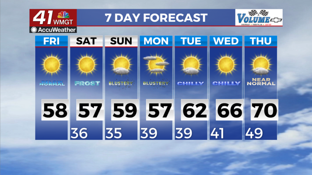
MACON, Georgia (41NBC/WMGT) – An initial cold front has swept through the area, resulting in a drier and cooler airmass alongside gusty northwest winds. A secondary front has pushed 


towards the Tennessee Valley making rapid progress into our area this morning. The more notable colder air will filter into the area in the wake of this front on Friday, resulting in high temperatures well below normal, ranging from the 40s in the mountains and through the 50s for the bulk of the area. Alongside gusty northwest winds, today will feel like the most Fall-like or Winter-like, if you ask someone who doesn’t like cooler weather day we’ve had so far this season. The most notable impact of this big cooldown will be the likelihood of the first freezing 


temperatures of the season for some areas by Saturday morning. The areas most likely to see a light freeze will be across western and parts of North Georgia, mostly west and north of the Atlanta metro. For this reason, a Freeze Watch is currently in effect for these areas Saturday morning. The remainder of the area will likely dip into the mid 30s, presenting a frost risk. However, this won’t be the coldest night of the week, as a more widespread freeze is expected, heading into the long term forecast period. Finally, a few flurries can’t be ruled out Friday night into early Saturday morning, mainly on the northwest facing high peaks of the northeast Georgia mountains, but any accumulations or impacts will be displaced farther north into North Carolina and Tennessee.