
Seasonal days continue for another day
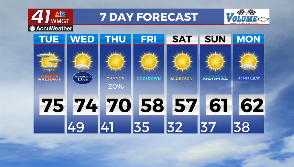
MACON, Georgia (41NBC/WMGT) – Temperatures will continue to run a few degrees above seasonal normal with highs in the low to mid 70s through the next couple of days. Overnight lows over 


the next few days will moderate to the 40s and 50s, giving us a break from the near freezing temperatures of the past few nights. Skies will be mostly clear as dry air bring humidity down to the 30s during the afternoon. Winds will be light out of the NW at less than 10 mph during the day, becoming light and variable overnight. Overall, an excellent couple of Fall days. Starting Wednesday, a relatively warm air mass is in place. Moisture will be on the increase, but the best surface moisture may still lie further to the south, keeping things dry across the region. There is some uncertainty here keeping in mind given that their is a cutoff low over Texas that will be progressing across the area, but again, moisture appears to be limited which should prevent any rain. 


Highs will be in the 70s areawide, which is 5-10 degrees above average. Overnight, cloud cover will increase ahead of the approaching system. Aloft, a shortwave digs into the area with a broader trough. Models are beginning to agree that the best surface pressure falls will occur further to the north across the Ohio Valley. This will limit moisture uptake for the system. Still, it will have some access, and it looks like North Georgia will be the best place to see some rain late Wednesday into early Thursday morning. A front pushes into the area on Thursday, so temperatures may remain similar to the morning temperature through the day across parts of North Georgia, while Middle Georgia will see highs climb into the 70s again ahead of the front. Some wrap around moisture is possible with the larger low that develops off the coast and moves into the northeast Thursday night into Friday. Into the weekend, cold air moves in with the surface high pressure. We swing the other direction with high temperatures in the 50s and low 60s Friday and Saturday. These highs will be 5 to 15 degrees below average, and some locations in the mountains may be as much as 20 degrees below average. The weather will be dry otherwise. This will likely bring a freeze to much of North Georgia with a hard freeze possible in some locations.