
A mild and dreary Halloween for Middle Georgia
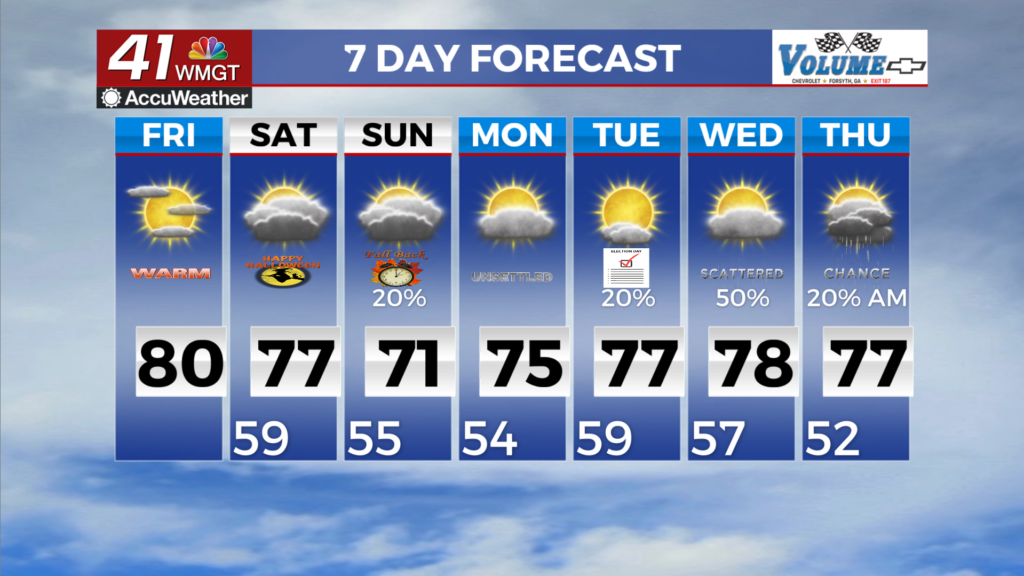
MACON, Georgia (41NBC/WMGT) – A mid-level ridge continues to amplify over the area through Friday as high pressure anchored over the Appalachians keeps the status quo nice weather 


through the short term. Winds will continue out of the northeast as around 5-10 mph with a few low end gusts possible. There will be a general increase in cirrus clouds spreading across the region today ahead of our next developing weather system. Friday night, the ridge begins to dampen in response to a developing shortwave and associated trough digging into the ArkLaTex region, which will drive a change in the weather for our area by the second half of the weekend. Temperatures will run anywhere from 5 to 8 degrees above normal for this time of the year, over the next couple of days. Highs in the mid to upper 70s to low 80s and lows in the upper 40s to upper 50s. The long term picks up as a weak system is expected to work it’s way through the Southeast. The GFS model has come into line with the Euro, showing the likelihood of receiving more than a half of inch of rain has fallen to less than 50 percent across the region. While showers and possibly a rumble of thunder are possible Saturday night into Sunday morning, we aren’t expecting anything significant in terms of potential rain. As a result, Sunday doesn’t look like the washout we have been expecting. Any lingering rain will clear out late Sunday afternoon and we’ll have another few days of pleasant weather with highs in the low to mid 70s before a stronger low pressure system pushes in from the Great Plains on Wednesday. There is still some uncertainty in the forecast when it come to rainfall totals and coverage, but temps are expected to fall into the upper 60s and low 70s after the front passes with overnight lows falling back towards the upper 40s by the second half of the work week.