Dry & seasonal weather prevails through Friday for Middle Georgia
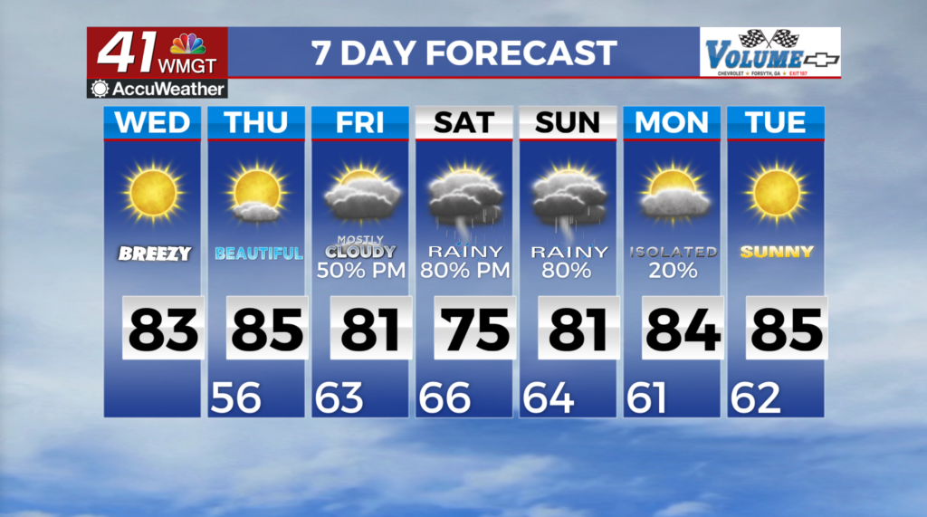
MACON, Georgia (41NBC/WMGT) – Surface high pressure remains in place across the Mid-Atlantic states resulting in mostly dry and fairly seasonal temperatures across the region through 


early Thursday. Highs on Wednesday in the 70s to low 80s under sunny skies for most with lingering cloudiness across the far southern tier of counties. The extended period begins dry with high pressure centered over the Carolinas and North Georgia. Near seasonal to slightly above seasonal temperatures, thanks to a mid-upper level pattern that favors subsidence and high pressure across the Southeast. This ridge begins to break down Friday allowing the old frontal boundary across Central Florida to begin moving back north. Our eyes will be on the Gulf over the coming days regarding the development of an area of low pressure currently in the southwestern Gulf. The National Hurricane Center (NHC) has an almost 100 percent chance of tropical formation over 


the next 48 hours. Features that will impact the track of this system include: The high pressure along the Eastern Seaboard (which could induce cold air damming or the wedge across Georgia and a trough across the U.S. The steering flow between these two features should bring whatever comes of the system northward into the northern Gulf and somewhere along the Gulf Coast region. As far as potential impacts to North and Middle Georgia it’s much too early to say. Right now the biggest impact will be the amount of rain across the region but exactly where and how much is still up in the air. We should also see some breezy conditions but like the precipitation, just how strong will be highly dependent on the eventual track of the storm. At this time, sustained winds up to 15 mph and gusts up to 25 to 30 mph are on the table. Flash flooding and/or rises on rivers, creeks, and streams would also be possible. The current models do show this tropical system making landfall this weekend and making its way northward into the beginning of next week. The differences in timing, location, and intensity vary greatly but they all do show it weakening substantially with drier airmass moving into the region by Monday/Tuesday. As we get into next week this should bring cooler daytime high temperatures in the 70s to lower 80s.