Gradual improvement with cooler temperatures in store for Middle Georgia
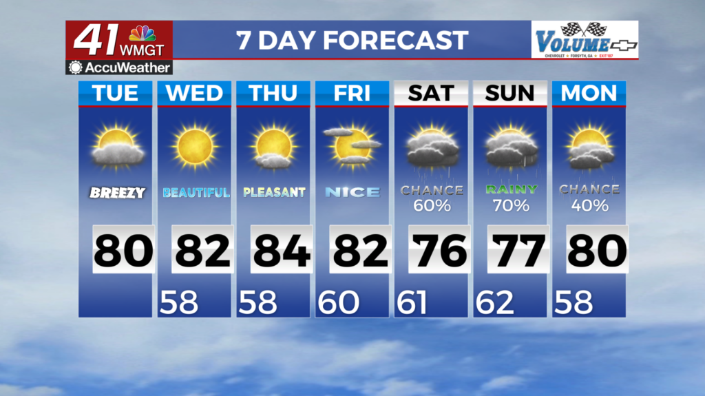
MACON, Georgia (41NBC/WMGT) – We are expecting things to improve with clear skies and cooler temperatures. Currently we have some patchy fog across the state with clearing conditions 


moving into northwest Georgia. The frontal boundary that brought rain to the area over the weekend is slowly moving south through the state with a drier, cooler airmass moving into Northwest Georgia behind it. High pressure is centered over the Mid-Atlantic states is building down the Eastern Seaboard becoming wedge-like Tuesday into Wednesday. Cooler east to northeast flow sets up clearing things out with high temps today expected mainly in the 70s to near 80. Low temperatures tonight will dip into the 60s with lows Tuesday night down into the 50s across Northeast 


Georgia. High temperatures in the mid to upper 70s will start off the long term forecast. Overnight lows will fall into the 50s with 40s likely in the higher elevations of Northern Georgia. By the time we get to Thursday, rain chances for the coverage area drop to nearly zero as the stationary front sinks into Florida. The National Hurricane Center is keeping an eye on a disturbance off the Yucatan that they’re giving a 80 percent chance of development in the next 7 days. All of the major models are developing it into some kind of tropical system with landfall expected somewhere along the Gulf Coast east of New Orleans. This would bring another round of wet weather to the area by next weekend. The extent and intensity of this system is currently only speculation and there is still a lot of uncertainty as to what and where this system will do. It’s presence will force the stationary front across northern Florida back north and it seems likely that regardless of the track the storm takes, we’ll likely have another wet weekend.