

Another warm day for Middle Georgia
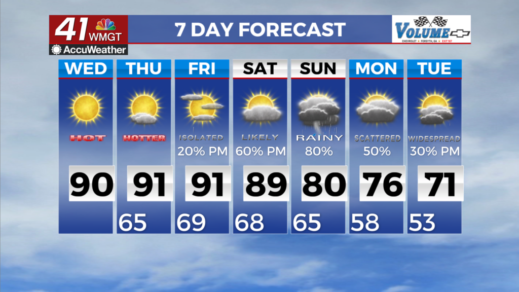
MACON, Georgia (41NBC/WMGT) – Wednesday morning begins with temperatures ranging from the mid 50s in far North Georgia to the mid 60s in East Central Georgia. With the ridge 


centered over the Southeast and moisture continuing to increase, conditions will definitely feel more Summerlike. Highs on Wednesday climb into the upper 80s to low 90s in all but the mountains, which will be about 8 to 12 degrees above normal for the last day of September. The influence of the ridge will also inhibit rain chances through the day. As we approach the weekend, the ridge will begin to break down and southerly flow begins to pull moisture back into the region. This will bring chances for thunderstorms back up to between 20 to 30 percent during the 


afternoon on Friday with more widespread thunderstorms likely through the weekend. Temperatures should remain moderated to the upper 80s and lower 90s, although that still has them running 5 to 10 degrees above normal for this time of the year. We’ll keep an eye on Sunday, as the best dynamics move through the area for stronger thunderstorms. The models build in plenty of instability and decent low level shear, although the GFS model tends to keep a majority of the bulk shear off to the north. Regardless of severe weather, the concern for flash flooding will persist through the weekend and into early next week before the front finally clears out. The amount of rain we will get will likely change as the forecast window gets closer, but some models are calling for up to 5 inches total from Friday to late Tuesday, mainly along and north of I-85.