
Triple digit heat index values plague Middle Georgia
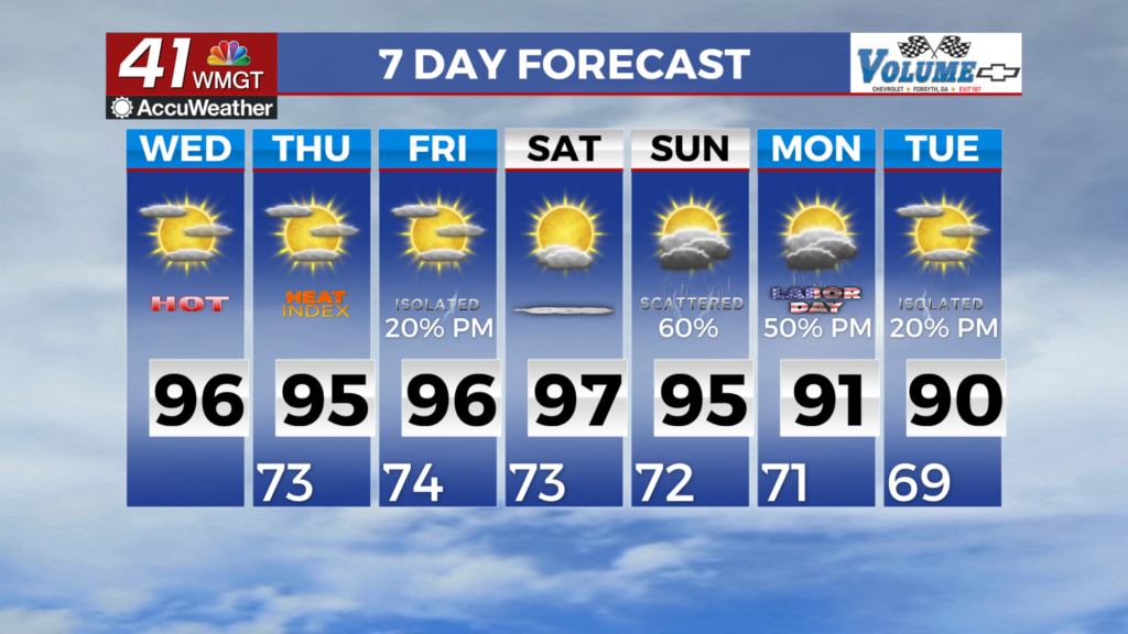
MACON, Georgia (41NBC/WMGT) – Partly cloudy skies with high pressure centered just north of the state keeps things dry across the area. There is a decent amount of moisture across the 


region as this high pressure ridge keeps things mostly dry through the short term forecast. We could see an isolated shower/thunderstorm or two this afternoon mainly across Middle Georgia being furthest away from the ridge center. No severe storms are expected. Daytime highs will mainly be in the lower to middle 90s with lows in the lower 70s to upper 60s. The extended period begins with a fairly dominate midlevel ridge centered over the Tennessee Valley. As a result, afternoon highs will continue to reach into the 90s in most locations except the mountains. Heat index values will flirt with a Heat Advisory for Middle and Eastern Georgia Thursday, Friday and especially Saturday. All of the models are in good agreement that reinforcing and much stronger 


northern stream trough will dig southeast through the Mid-Atlantic and begin to break down the eastern fringe of the ridge by Saturday. This will drive a backdoor front through the region late Saturday into Sunday. Chances of showers/storms do increase for the weekend both as a result of less of a suppressive ridge and because of the enhancement along the approaching frontal boundary, which could take the form of a convective complex Saturday afternoon/evening. About the only noticeable change will be a shift in the wind direction to the north or northeast by Sunday and increased afternoon/evening thunderstorm activity with the center of the ridge pushed back to the west of Texas and a broad northwest flow in place across the southeast through the remainder of the extended forecast. Afternoon highs could come down somewhat by Monday as more afternoon activity is expected, with highs only touching 90 on Labor Day and widespread 20 to 40 percent chances for precipitation.