High temps and heat index values bake Middle Georgia
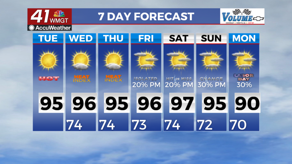
MACON, Georgia (41NBC/WMGT) – The expansive upper ridge over the south-central U.S. continues to build eastward. Temperatures will notch higher today, as a result, bringing high 


temperatures into the mid 90s for most areas. Heat index values will also push near or over 100 degrees for most areas by Tuesday afternoon, although short of Heat Advisory criteria of 105. As far as any potential for rain, it’ll be few and far between. While a rogue shower or brief thunderstorm can’t be ruled out, Tuesday will bring even less potential with the vast majority of locations remaining dry as subsidence (descending motion of air over a broad area) increases further. The expansive ridge slides east on Wednesday, centering over the central and southern Appalachians. 


For Middle Georgia, this will result in another warm and mostly rain-free day. Tropical moisture from over the Atlantic/Florida will start to push northward into the southern side of the ridge, so we can’t rule out some afternoon showers and storms in far southeast areas. High temps will remain in the low to mid 90s, with heat index values peaking around 100-105. Uncertainty in the forecast increases substantially for the Thursday/Friday time period, as models have a significant spread in how the synoptic pattern evolves. Over the past 24 hours, there has been an uptick in  the number of ensemble groupings that have a shortwave trough and a slug of tropical moisture surging up across Florida into Georgia and squeezing out the ridge. On the flip side, there is another group of ensembles that have the ridge holding in place and shunting the tropical moisture off to the southwest, which would keep rain chances very low over our area. With either solution and anything in between, temperatures will remain at or above normal through the weekend, with highs in the upper 80s to low 90s.