

Dangerous heat & humidity roasts Middle Georgia
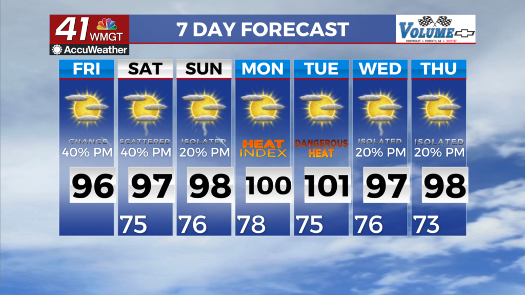
MACON, Georgia (41NBC/WMGT) – A Heat Advisory is in effect for Middle and North Georgia until Saturday 8 PM. Temperatures will continue their steady climb Friday and into the weekend as 


a ridge draws closer to Georgia. High temperatures on Friday will rise into the mid to upper 90s. With ample moisture lingering even under the ridge , heat index values tomorrow will rise into the mid to upper 100s in all but the far northeastern mountains. Deep moisture will also ensure that there is little relief overnight, with low temperatures in the mid to upper 70s flirting with record 


high minimum Friday and Saturday morning. The eastward movement of the ridge will serve to displace our persistent northwesterly flow regime away from our area. This will at least inhibit the evolution of storms, but lingering moisture will ensure that isolated to scattered storms will be able to develop Friday afternoon. Strong instability and high moisture levels will once again favor a 

few strong storms capable of producing gusty winds and locally heavy rain once again. Broad ridging will extend across the southern and southeastern U.S. as we close out the weekend and head into early next week. As such, temperatures will remain above normal with heat index values over 100 across the bulk of the area during this time frame. Additional Heat Advisories are likely to continue for portions of the area where heat index values over 105 occur.