Another round of storms head to Middle Georgia
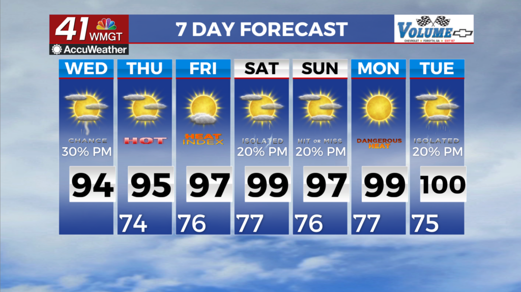
MACON, Georgia (41NBC/WMGT) – Wednesday will be much like a carbon copy of the last few days as scattered showers and thunderstorms develop across the area this afternoon. We expect 


the wedge to build in a bit further with northwest flow keeping things going. Temperatures Wednesday will be very similar to Tuesday with highs in the upper 80s to the middle 90s. As the long term sets up, a strengthening ridge will be building in for the weekend. Chances for afternoon storms will start to decline, while the risk for excessive heat ramps up. By Friday, most of the coverage area can expect feels like temps in the triple digits with the eastern part of the forecast area reaching the Heat Advisory criteria. If you have plans for this coming weekend keep the heat in mind. 


Over the next couple of days we’ll be transitioning into northwesterly flow. This kind of pattern is notorious for letting MCS’ (Mesoscale Convective System), a group of complex of t-storms that become better organized on a scale larger than individual storms that persists for several hours, make a big run across half the country and end up on our doorstep. Long term models struggle to pick these out from the rest, and as a result we’ll just need to wait and see how the ridge sets up over the next few days. These ridge riders also have a habit of interrupting forecasted high temperatures with the introduction of rain, making the long term forecast a bit more tricky.