The typical summer pattern continues
MACON, Georgia (41NBC/WMGT) – Showers have come to an end for the most part across the area but with how long the shower activity lingered over portions of the area, confidence has 


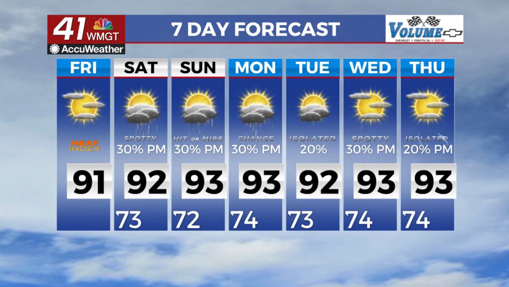
increased in low clouds and fog this morning in areas that received the most rainfall. The pattern remains unchanged across the region with the Bermuda high to our east and the ridging to our west with Georgia in the middle of it through Saturday likely. With this setup the area will result in scattered to numerous showers and thunderstorms again today and Saturday. The main threats 


will continue to be strong gusty winds, heavy rainfall, and frequent lightning. Although the severe risk is low, we cannot rule out a severe warning or two through Saturday. Temperatures will remain for the most part within a degree or two of normal, rising to the upper 80s to low 90s across the area. Typical summertime convection pattern with triple digit heat index values return this 

weekend. Conditions are expected to flirt with heat advisory criteria at the beginning of next work week, especially in the southeast portion of the coverage area. Fortunately, thunderstorms will be expected each afternoon which may help ease temperatures during peak heating. There is pretty good agreement that afternoon convection will form everyday for the foreseeable future, although no strong signal for severe weather exists with limited shear in place. The strength of the storms will ultimately depend on heating.