Another chance for showers & storms in store for Wednesday
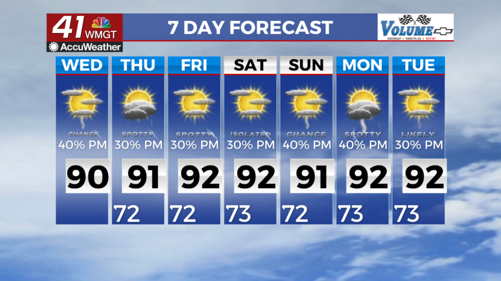
MACON, Georgia (41NBC/WMGT) – Models are in good agreement that the midlevel low that has been parked over our region for the last few days will finally begin to dissolve as it shifts off 


toward the northeast through Wednesday. Our area will remain in a moist southwest flow along the edge of a strengthening Bermuda High pressure. This will reinforce the continuation of a summertime patten with decent moisture levels and diurnal thunderstorm chances each day. The coverage of thunderstorms will be scattered to numerous through the period with plenty of 

instability over the region. In addition, ample afternoon cloud cover will suppress high temperatures by a few degrees through Friday before higher heights build by late week, allowing for temperatures to climb into the upper 80s to low 90s as the high builds in closer to our area. While no organized severe weather is expected, a few storms may become strong with gusty winds as the primary threat, in addition to localized flash flooding in areas with prolonged convective activity. Highs will remain in the mid 80s to lower 90s, with overnight lows in the upper 60s to lower 70s.