Drier conditions for Friday, then rain arrives Saturday
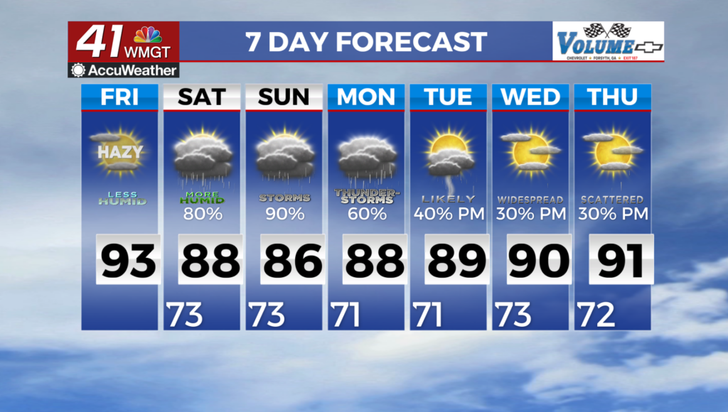
MACON, Georgia (41NBC/WMGT) – Dry air continues to funnel into the area which is leading to overall pleasant conditions across the area. With the drier air being funneled in, smoke is also 


pushing into the area which has led to hazy skies in the area as well as the more orange sunsets you’ve seen. Likely will not see improvements in this until Saturday. Temperatures Friday morning will be the lowest we’ve seen in a while with temps in the mid 60s to low 70 from north to south with upper 50s possible in the higher elevations of northeast Georgia. High temperatures Saturday will be similar to yesterday topping out in the upper 80s to low 90s. What leads to the pleasant conditions will be the dewpoints which will continue to be below the upper 60s for much of the area 


through Friday. These lovely dry conditions are coming to an end Friday night as the next frontal system pushes into the state just before daybreak Saturday. Friday morning, a closed low center begins to deepen over Kansas as it pushes into Missouri Friday evening. Its trailing cold front pushes through the Mid/Southern Mississippi River Valley Friday night and begins knocking on Northwestern Georgia’s doorstep just before daybreak Saturday. By Saturday morning, the main low pressure center moves northeast into the Central Great Lakes and into the Mid-Atlantic states. The frontal boundary on the other hand stalls across east-southeast Georgia and the Carolinas as a developing Bermuda ridge blocks it from moving offshore. With the state of Georgia on the periphery of this Ridge, it will keep us in moist southwesterly flow. This will keep precipitation chances elevated with a diurnally driven trend each day. With showers and thunderstorms expected each day, high temperatures will only get into the 80s to near 90 Sunday through Wednesday.