
Another front brings additional chances for storms
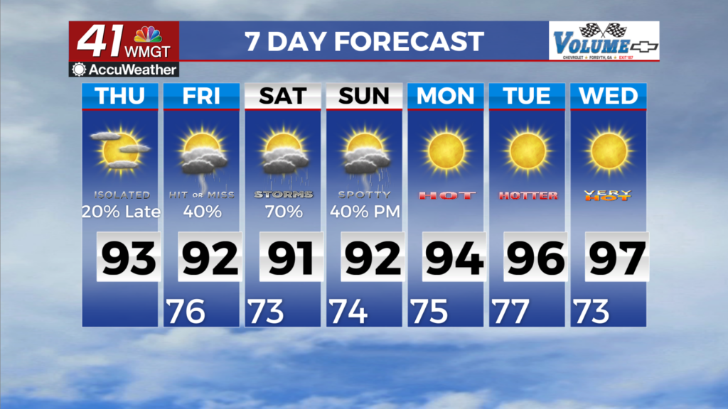
MACON, Georgia (41NBC/WMGT) – Moisture continues to stream in from Bertha and a frontal boundary becomes the focus for showers and thunderstorms. Scattered to numerous thunderstorms 


become more prevalent across the area pushing into Thursday. Thunderstorms will be most likely during the afternoon and evening timeframe but showers will likely be in place through much of the day. A Flood Watch has been issued beginning at 8 PM tonight and will continue through late Friday night. One positive of the increased rainfall is increased cloud cover. This will ultimately lead to decreased heat indices at least for North Georgia. Today they should top out in the upper 90s to near 100, but tomorrow we will see heat indices in the low to mid 90s for North Georgia and 


up to 100 for the remainder of the area. Temps will be in the mid to upper 80s for far North Georgia and low to mid 90s for the remainder of the area. The extended period begins with the region locked in a slightly westerly flow atop a diffuse and washed out frontal boundary and sandwiched between the Bermuda ridge over Florida, upper trough over the Great Lakes and Bertha over Texas. This flow pattern puts North Georgia in the perfect location for moisture to pool and flow parallel to the surface boundary, while also allowing weak disturbances to migrate across the region within the weak upper flow. By Saturday, Bertha moves out of the picture and a stronger disturbance within the slowly moving northwest flow moves towards the area. If something can 
organize across Kentucky or Tennessee, there could be a low end severe risk, but the flood risk is likely to continue given the continued higher water values. By Sunday, the disturbance that rolls through on Saturday helps deepen the trough across the eastern U.S. setting up our region in full fledged northwest flow. Drier air is forecast to infiltrate the area in the mid levels, but there is not any discernable push in the lower levels; meaning the higher, low to mid 70 dewpoints will remain in place through the extended. Confidence in the Sunday to Wednesday portion of the forecast is low given the uncertainties in dealing with northwesterly flow regimes. Models suggest more drier air, however a lack of any real inhibition or cap suggests we could still have some storms around. The other part of the period, specifically Monday through Wednesday is the possibility of a northwesterly flow disturbance. For now, the extended has a lower confidence forecast and one we will need to watch for both severe and heat hazards.