
After a cool start, warm temps for the weekend
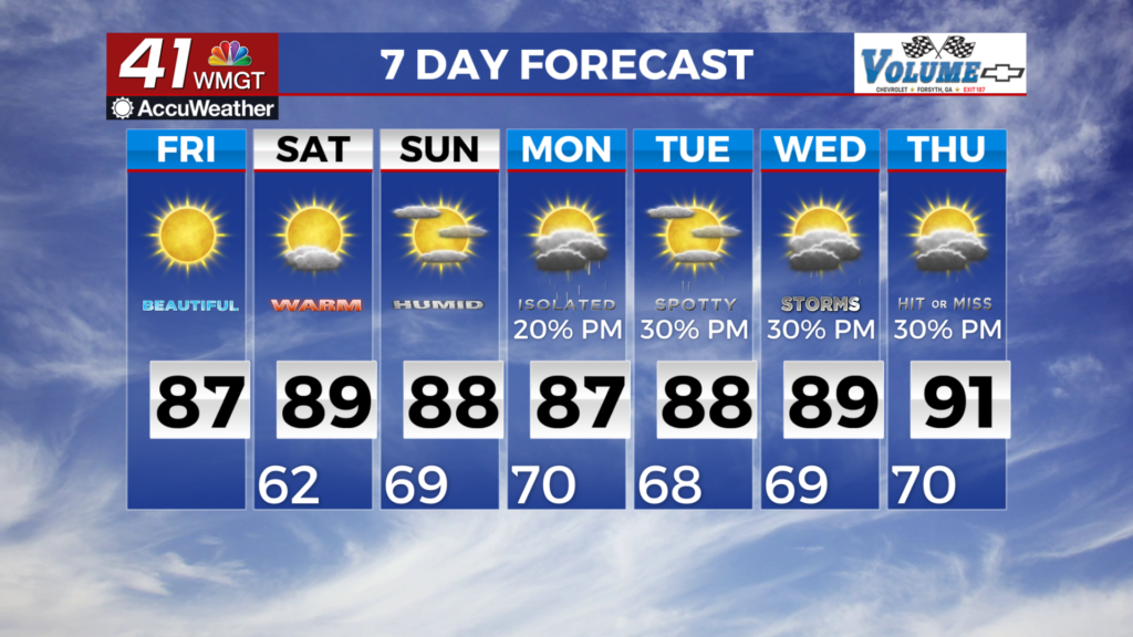
MACON, Georgia (41NBC/WMGT) – Surface high pressure over the Southeast will promote continued dry weather and warming temperatures for North and Middle Georgia today and Saturday. 


Other than some passing high clouds, expect sunny skies with temperatures warming into the 80s areawide. High pressure will begin to slide to the east and we’ll see a return to more southerly winds. Temperatures may be a touch warmer than yesterday. More of the same can be expected by Saturday, although temperatures will climb into the mid to upper 80s maybe lower 90s across 


parts of Middle Georgia. The extended forecast will largely be characterized by a gradual increase in rain chances, primarily of the diurnal variety. Mid-level ridging begins to flatten southward by late weekend with some slight moisture return, primarily west of the state. A more appreciable increase in moisture and resultant diurnal rain chances as southwesterly flow becomes more prevalent by Monday. By midweek, a general return to a muggier, more summer-like airmass punctuated by daily enhanced convection can be expected. Uncertainty remains by midweek regarding the pattern evolution as a surface high drops into the Northeast, potentially sending a backdoor front southwestward, although whether it makes it this far southwest is unclear. Temperatures will remain fairly seasonal with highs mainly in the 80s and lows ranging through the 60s to near 70.