Warm and dry weather continues
MACON, Georgia (41NBC/WMGT) – High pressure over the Southeast will keep conditions warm and dry across the area over the next few days. Temperatures climb from the 50s this morning, 


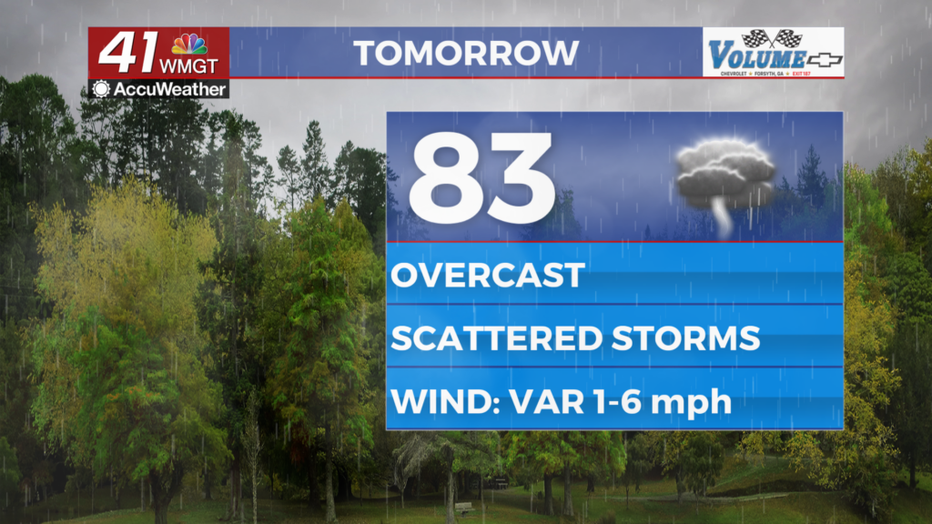
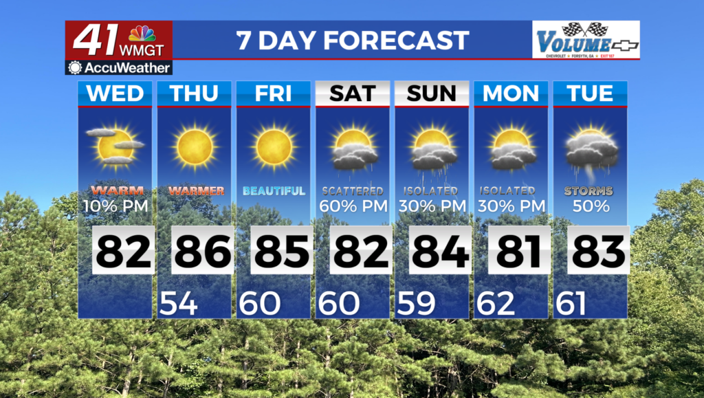
to the mid 80s this afternoon under mostly cloudy skies with only some fair weather clouds around. With very dry vegetation and relative humidity values falling into the 20 percent range during the afternoon and early evening, a Fire Danger Statement has been issued for the entire area. With another night of mostly clear skies and light winds, overnight lows will fall to the low to mid 50s. Temperatures on Thursday will warm a degree or two from today, with afternoon highs climbing into the mid to upper 80s. It’s no surprise that another Fire Danger Statement will likely be issued for the area with relative humidity again falling into the 20 to 30 percent range. South to southwest winds will be on the light side avoiding a critical fire conditions statement being issued, only peaking around 5 to 7 mph during the afternoon. An upper level ridge moves across the eastern U.S. Thursday night into Friday while high pressure centered to the southeast of Georgia gradually weakens. Warm and dry conditions are expected to persist under the ridge through Friday in spite of southwesterly low level flow on the backside of the high. Overnight lows are expected to range from the mid 50s to near 60. High temperatures will be about 8 to 12 degrees above normal across the area, rising into the mid to upper 80s. With strong daytime mixing, relative humidity values are expected to drop to between 25 to 35 percent on Friday afternoon. With very dry fuels and ongoing drought conditions, a Fire Danger Statement will likely be issued for at least a portion of the area again. A large scale change in the upper level flow pattern begins on Friday night into Saturday morning. As the axis of the ridge clears Georgia to the east, troughing extending from a closed low over the northern High Plains swings through the Mississippi River Valley region. As this trough rotates northeastward, it will drive a surface low through the Midwest, which in turn advances a cold front towards north Georgia. Showers and thunderstorms ahead of this front are anticipated to enter far northwest Georgia late Friday night, advancing south and east over the course of the day on Saturday as the front slowly pushes through the area. Low level shear and forcing ahead of the front are expected to be weak at this time, limiting the potential for severe weather. An unsettled pattern persists on Sunday and into next week as the front stalls across south/Middle Georgia.