The warm up begins for Middle Georgia
MACON, Georgia (41NBC/WMGT) – Surface high pressure continues to move southeast. Winds will shift to the southwest and low level moisture begins to increase overnight Wednesday. In 


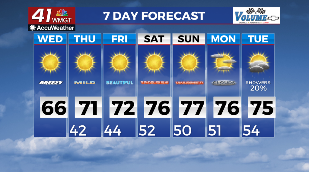
 spite of increasing dewpoints, precipitation is not expected on Wednesday. A warming trend continues under high pressure, with highs climbing into the low to mid 60s in North Georgia and upper 60s in Middle Georgia. The worst of the cold is behind us. The area will slowly see a steady rise in temperatures through the remainder of the work week. Especially in afternoon high temps which are expected to fight their way back up into the low to mid 70s by the weekend. Overnight lows will gradually increase from the mid 40s to the 50s by the weekend. Other than that, the weather pattern becomes pretty much on cruise control again. Models are still conflicted about the timing and possibility of a front that may bring another shot of rain and a few thunderstorms towards the end of the weekend, but expect increasingly warm and pleasant conditions for the rest of the week.