Warm up begins and runs through the weekend
MACON, Georgia (41NBC/WMGT) – The ongoing benign weather continues through the short term period. Dry and mostly clear skies remain the rule as surface high pressure centered over Ontario slides eastward. Thursday morning lows will be a couple degrees warmer than Wednesday, they will still remain several degrees below normal, ranging from the mid 50s to low 60s. 


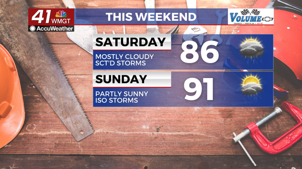
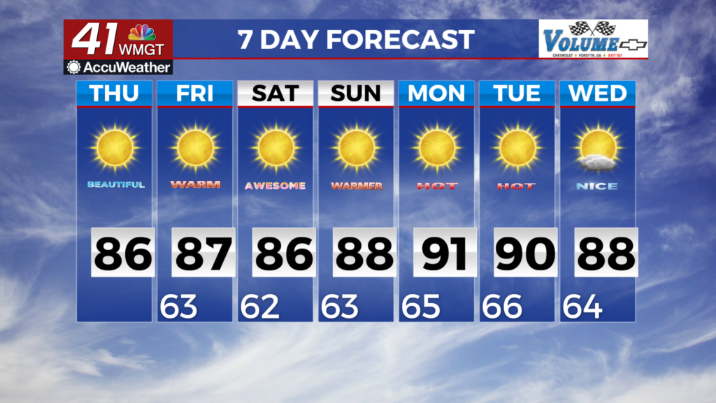
 Thursday afternoon highs will continue the ongoing gradual warming trend. In fact, a few 90s will likely reemerge with upper 80s largely the rule. Overall the weather pattern will remain unchanged through the long term period with sunny and dry conditions expected. Weekend temperatures should stay in the mid to upper 80s before high pressure fully settles into the eastern U.S. resulting in temps beginning to creep back into the low to mid 90s. Temperatures will generally range from 7 to 12 degrees above normal for this time of year. Long range models are not showing much of a change in this pattern. The precipitation outlook does have us leaning above average for precipitation. This may finally mean we may finally see some rain ease into the forecast.