Isolated showers and storms eventually will lead to slight cooldown
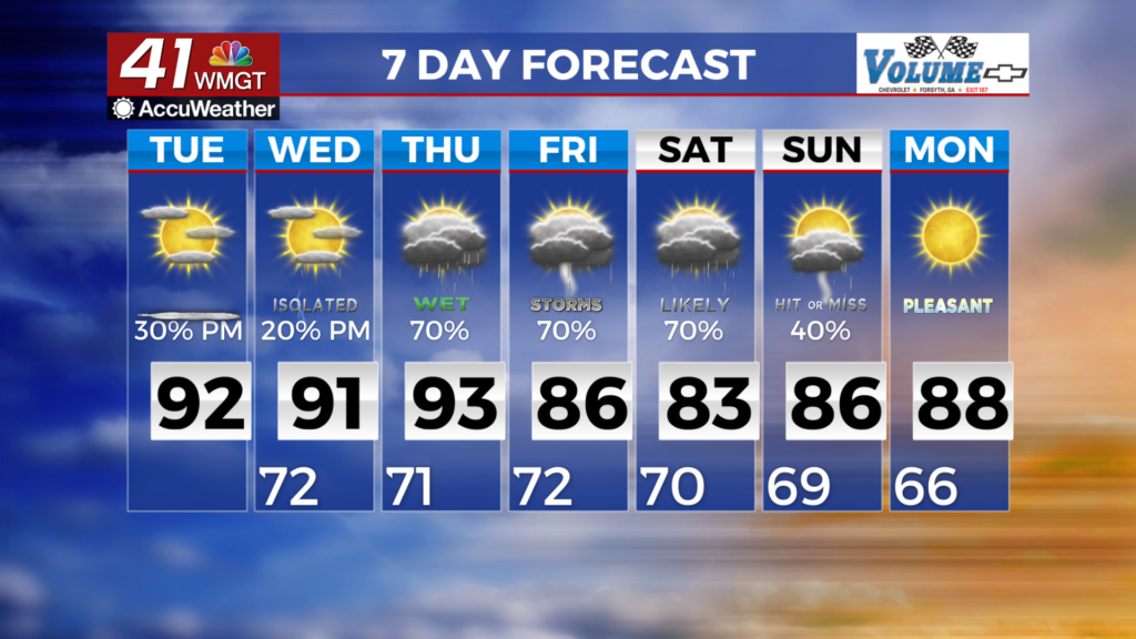
MACON, Georgia (41NBC/WMGT) – Mid to upper level ridge continues across the area through most of the week. Weak ridging develops over the Mid Atlantic region today pushing down the 


 eastern seaboard tonight setting up a wedge across the area. This wedge is nowhere near as strong as the one we saw a few weeks aga that kept the area overcast and temperatures in the 70s for a week. This wedge is acting more like a steering mechanism helping to keep Hurricane Erin off the Georgia/Carolina coast. By this afternoon, Erin will be positioned about 600 miles southeast of the Georgia coast and will be turning North/Northeast through Wednesday morning. We will see mainly easterly flow and some increased moisture with this wedge but it will only help to increase afternoon convective coverage Tuesday afternoon. High temperatures within this wedge feature (Northeast Georgia) are forecast to be limited to the mid to upper 80s, with highs elsewhere in the low to mid 90s. Low temps tonight and Tuesday night will mainly in the 70s with 60s across the Northeast Georgia mountains. For Wednesday and Thursday, it will be dominated by the presence of Hurricane Erin along the East Coast of the U.S. No direct impacts (in terms of heavy rain or strong winds) are expected from Erin in north or Middle Georgia.