Seasonal temperatures return by midweek as showers increase
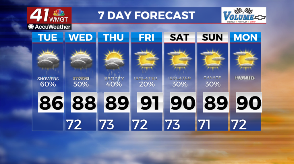
MACON, Georgia (41NBC/WMGT) – Expect another round of low morning clouds, as well as scattered to widespread showers and a few storms. The extended forecast continues with afternoon and evening showers and thunderstorms expected each day. Temperatures also climb back to near seasonal norms by Thursday/Friday with highs back to near 90 north to the mid 90s across 


 Middle Georgia. Starting Wednesday, the upper level ridge over the Atlantic from the short term will move east becoming centered just off the western Florida coast. This upper level ridge will keep deep moist southwesterly flow over Georgia from pushing into the area. This flow becomes a bit more westerly by Friday keeping moist flow over the area through the weekend. With daytime heating and temps expected to get back up to seasonal norms we will continue to see afternoon and evening showers with increased chances of thunderstorms through early next week. This strong upper level ridge becomes centered over the northern Gulf by Friday/Saturday which will help to keep any storms that develop capped from becoming too strong or severe.